Dammarie geodata
Dammarie (Centre) is a populated place; located in France in Europe/Paris (GMT+2) time zone. With population of 1,432 people, there are 6472 cities with bigger population in this country. Compared to other cities in France, 65.3% of cities are located further ↓South; 63.1% of cities are located further →East and 54.5% of cities have lower elevation than Dammarie. Note1
Administrative division(s):
- Level 1: Centre
- Level 2: Département d'Eure-et-Loir
- Level 3: Arrondissement de Chartres
- Level 4: Dammarie


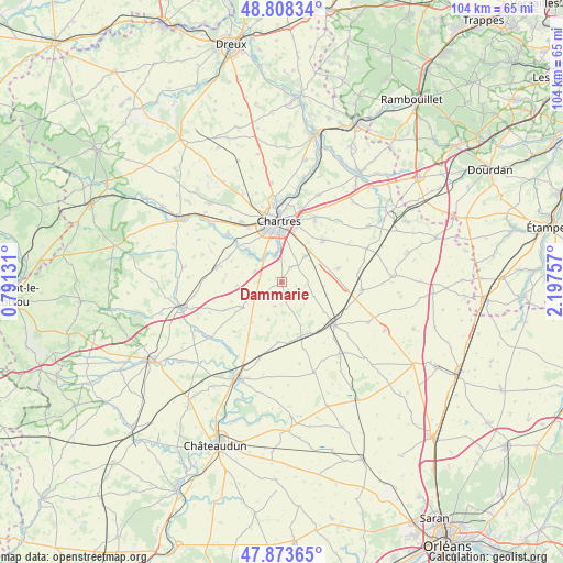
Dammarie GPS coordinates[2]
48° 20' 35.304" North, 1° 29' 39.984" East
| Map corner | latitude | longitude |
|---|---|---|
| Upper-left | 48.80834°, | 0.79131° |
| Center: | 48.34314°, | 1.49444° |
| Lower-right: | 47.87365°, | 2.19757° |
| Map W x H: | 103.9×103.9 km | = 64.6×64.6mi |
| max Lat: | 51.07786° ⇑34.7% North |
| Dammarie: | 48.34314° |
| min Lat: | ⇓65.3% South 41.3874° |
| min Long | Dammarie | max Long |
| -5.08615° | 1.49444° | 9.52242° |
| W 36.9%⇐ | ⇒63.1% E |
Elevation
Elevation of Dammarie is 148 m = 486 ft, and this is 45.7 m = 150 ft below average elevation for this country.
| Max E: |
2333 m = 7654 ft | 45.5% |
| Avg. | 193.7 m = 635 ft | |
| Dammarie | 148 m = 486 ft | |
Min E: |
-1 m = -3 ft | 54.5% |
See also: France elevation on elevation.city.
Geographical zone
Dammarie is located in North temperate zone (between Tropic of Cancer and the Arctic Circle). Distance of this North polar circle is 2025.9 km =1258.8 mi to North.| Distance of | km | miles | from Dammarie |
|---|---|---|---|
| North Pole | 4631.8 | 2878.1 | to North |
| Arctic Circle | 2025.9 | 1258.8 | to North |
| Tropic Cancer | 2769.3 | 1720.8 | to South |
| Equator | 5375.3 | 3340.1 | to South |


Nearby cities:
15 places around Dammarie: (largest is in red/bold)
• Bailleau-le-Pin
12.5 km =7.8 mi,  282°
282°
• Barjouville
7.6 km =4.7 mi,  349°
349°
• Berchères-les-Pierres
6.4 km =4 mi,  43°
43°
• Chartres
11.5 km =7.1 mi,  358°
358°
• Fontenay-sur-Eure
8.5 km =5.3 mi,  313°
313°
• Le Coudray
8.7 km =5.4 mi,  2°
2°
• Le Gault-Saint-Denis
12.2 km =7.6 mi,  183°
183°
• Lucé
10.7 km =6.6 mi, 347°
• Luisant
9.7 km =6 mi, 350°
• Mainvilliers
12.2 km =7.6 mi, 346°
• Mignières
5.4 km =3.4 mi,  289°
289°
• Morancez
6.4 km =4 mi, 359°
• Prunay-le-Gillon
10.7 km =6.6 mi,  77°
77°
• Sours
10.7 km =6.6 mi,  45°
45°
• Thivars
5.1 km =3.2 mi,  321°
321°
Sources, notices
• [Note1] Compared only with cities in France existing in our database
• [Src1] Map data: © OpenStreetMap contributors (CC-BY-SA)
• [Src2] Other city data from geonames.org with taken over terms of usage.
• [Src3] Geographical zone / Annual Mean Temperature by Robert A. Rohde @ Wikipedia
