Le Coudray-Saint-Germer geodata
Le Coudray-Saint-Germer (Hauts-de-France) is a populated place; located in France in Europe/Paris (GMT+2) time zone. With population of 936 people, there are 9332 cities with bigger population in this country. Compared to other cities in France, 88.1% of cities are located further ↓South; 58.9% of cities are located further →East and 72% of cities have lower elevation than Le Coudray-Saint-Germer. Note1
Administrative division(s):
- Level 1: Hauts-de-France
- Level 2: Département de l'Oise
- Level 3: Arrondissement de Beauvais
- Level 4: Le Coudray-Saint-Germer
Current local time in Le Coudray-Saint-Germer:
07:20 AM, SaturdayDifference from your time zone: hours


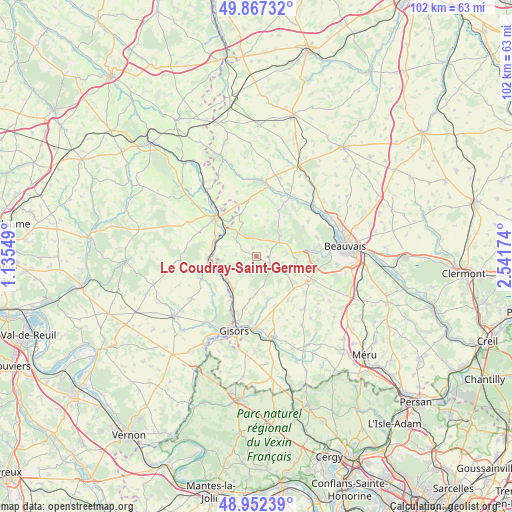
Le Coudray-Saint-Germer GPS coordinates[2]
49° 24' 43.164" North, 1° 50' 18.996" East
| Map corner | latitude | longitude |
|---|---|---|
| Upper-left | 49.86732°, | 1.13549° |
| Center: | 49.41199°, | 1.83861° |
| Lower-right: | 48.95239°, | 2.54174° |
| Map W x H: | 101.7×101.7 km | = 63.2×63.2mi |
| max Lat: | 51.07786° ⇑11.9% North |
| Le Coudray-Saint-Germer: | 49.41199° |
| min Lat: | ⇓88.1% South 41.3874° |
| min Long | Le Coudray-Sain | max Long |
| -5.08615° | 1.83861° | 9.52242° |
| W 41.1%⇐ | ⇒58.9% E |
Elevation
Elevation of Le Coudray-Saint-Germer is 230 m = 755 ft, and this is 36.3 m = 119 ft above average elevation for this country.
| Max E: |
2333 m = 7654 ft | 28% |
| Le Coudray-Saint-Germer | 230 m 755 ft | |
| Avg. | 193.7 m = 635 ft | |
Min E: |
-1 m = -3 ft | 72% |
See also: France elevation on elevation.city.
Geographical zone
Le Coudray-Saint-Germer is located in North temperate zone (between Tropic of Cancer and the Arctic Circle). Distance of this North polar circle is 1907.1 km =1185 mi to North.| Distance of | km | miles | from Le Coudray-Saint-Germer |
|---|---|---|---|
| North Pole | 4513 | 2804.2 | to North |
| Arctic Circle | 1907.1 | 1185 | to North |
| Tropic Cancer | 2888.2 | 1794.6 | to South |
| Equator | 5494.1 | 3413.9 | to South |


Nearby cities:
15 places around Le Coudray-Saint-Germer: (largest is in red/bold)
• Cuigy-en-Bray
1.8 km =1.1 mi,  331°
331°
• Flavacourt
8.7 km =5.4 mi,  188°
188°
• Hébécourt
10.4 km =6.5 mi,  231°
231°
• La Houssoye
9.8 km =6.1 mi,  130°
130°
• Lachapelle-aux-Pots
6.2 km =3.9 mi,  48°
48°
• Lalande-en-Son
4.6 km =2.9 mi,  240°
240°
• Le Vauroux
7.2 km =4.5 mi,  120°
120°
• Ons-en-Bray
6.1 km =3.8 mi,  85°
85°
• Saint-Aubin-en-Bray
3 km =1.9 mi,  71°
71°
• Saint-Germer-de-Fly
5.5 km =3.4 mi,  308°
308°
• Savignies
10.9 km =6.8 mi,  57°
57°
• Senantes
8.3 km =5.2 mi,  358°
358°
• Sérifontaine
8.2 km =5.1 mi,  218°
218°
• Talmontiers
7.6 km =4.7 mi,  246°
246°
• Villers-Saint-Barthélemy
8.2 km =5.1 mi,  101°
101°
Sources, notices
• [Note1] Compared only with cities in France existing in our database
• [Src1] Map data: © OpenStreetMap contributors (CC-BY-SA)
• [Src2] Other city data from geonames.org with taken over terms of usage.
• [Src3] Geographical zone / Annual Mean Temperature by Robert A. Rohde @ Wikipedia
