Talmontiers geodata
Talmontiers (Hauts-de-France) is a populated place; located in France in Europe/Paris (GMT+2) time zone. With population of 683 people, there are 12036 cities with bigger population in this country. Compared to other cities in France, 87.6% of cities are located further ↓South; 60% of cities are located further →East and 62.4% of cities have higher elevation than Talmontiers. Note1
Administrative division(s):
- Level 1: Hauts-de-France
- Level 2: Département de l'Oise
- Level 3: Arrondissement de Beauvais
- Level 4: Talmontiers


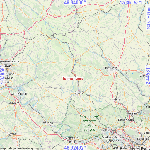
Talmontiers GPS coordinates[2]
49° 23' 5.172" North, 1° 44' 33.648" East
| Map corner | latitude | longitude |
|---|---|---|
| Upper-left | 49.84036°, | 1.03956° |
| Center: | 49.38477°, | 1.74268° |
| Lower-right: | 48.92492°, | 2.44581° |
| Map W x H: | 101.8×101.8 km | = 63.3×63.3mi |
| max Lat: | 51.07786° ⇑12.4% North |
| Talmontiers: | 49.38477° |
| min Lat: | ⇓87.6% South 41.3874° |
| min Long | Talmontiers | max Long |
| -5.08615° | 1.74268° | 9.52242° |
| W 40%⇐ | ⇒60% E |
Elevation
Elevation of Talmontiers is 96 m = 315 ft, and this is 97.7 m = 321 ft below average elevation for this country.
| Max E: |
2333 m = 7654 ft | 62.4% |
| Avg. | 193.7 m = 635 ft | |
| Talmontiers | 96 m = 315 ft | |
Min E: |
-1 m = -3 ft | 37.6% |
See also: France elevation on elevation.city.
Geographical zone
Talmontiers is located in North temperate zone (between Tropic of Cancer and the Arctic Circle). Distance of this North polar circle is 1910.1 km =1186.9 mi to North.| Distance of | km | miles | from Talmontiers |
|---|---|---|---|
| North Pole | 4516 | 2806.1 | to North |
| Arctic Circle | 1910.1 | 1186.9 | to North |
| Tropic Cancer | 2885.2 | 1792.8 | to South |
| Equator | 5491.1 | 3412 | to South |


Nearby cities:
15 places around Talmontiers: (largest is in red/bold)
• Bazincourt-sur-Epte
8.2 km =5.1 mi,  168°
168°
• Bézu-Saint-Éloi
10.3 km =6.4 mi,  195°
195°
• Cuigy-en-Bray
7.6 km =4.7 mi,  52°
52°
• Flavacourt
7.9 km =4.9 mi,  134°
134°
• Gisors
11.8 km =7.3 mi, 166°
• Gournay-en-Bray
11 km =6.8 mi,  353°
353°
• Heudicourt
8 km =5 mi,  228°
228°
• Hébécourt
3.7 km =2.3 mi, 198°
• Lalande-en-Son
3 km =1.9 mi,  75°
75°
• Le Coudray-Saint-Germer
7.6 km =4.7 mi,  66°
66°
• Longchamps
8.9 km =5.5 mi,  252°
252°
• Saint-Aubin-en-Bray
10.6 km =6.6 mi, 67°
• Saint-Germer-de-Fly
7 km =4.3 mi,  22°
22°
• Sérifontaine
3.9 km =2.4 mi,  150°
150°
• Éragny-sur-Epte
8.1 km =5 mi,  163°
163°
Sources, notices
• [Note1] Compared only with cities in France existing in our database
• [Src1] Map data: © OpenStreetMap contributors (CC-BY-SA)
• [Src2] Other city data from geonames.org with taken over terms of usage.
• [Src3] Geographical zone / Annual Mean Temperature by Robert A. Rohde @ Wikipedia
