Saint-Germer-de-Fly geodata
Saint-Germer-de-Fly (Hauts-de-France) is a populated place; located in France in Europe/Paris (GMT+2) time zone. With population of 1,833 people, there are 5173 cities with bigger population in this country. Compared to other cities in France, 88.5% of cities are located further ↓South; 59.6% of cities are located further →East and 60.4% of cities have higher elevation than Saint-Germer-de-Fly. Note1
Administrative division(s):
- Level 1: Hauts-de-France
- Level 2: Département de l'Oise
- Level 3: Arrondissement de Beauvais
- Level 4: Saint-Germer-de-Fly


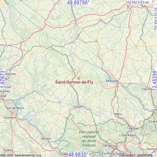
Saint-Germer-de-Fly GPS coordinates[2]
49° 26' 34.116" North, 1° 46' 47.496" East
| Map corner | latitude | longitude |
|---|---|---|
| Upper-left | 49.89786°, | 1.07673° |
| Center: | 49.44281°, | 1.77986° |
| Lower-right: | 48.9835°, | 2.48298° |
| Map W x H: | 101.7×101.7 km | = 63.2×63.2mi |
| max Lat: | 51.07786° ⇑11.5% North |
| Saint-Germer-de-Fly: | 49.44281° |
| min Lat: | ⇓88.5% South 41.3874° |
| min Long | Saint-Germer-de | max Long |
| -5.08615° | 1.77986° | 9.52242° |
| W 40.4%⇐ | ⇒59.6% E |
Elevation
Elevation of Saint-Germer-de-Fly is 101 m = 331 ft, and this is 92.7 m = 304 ft below average elevation for this country.
| Max E: |
2333 m = 7654 ft | 60.4% |
| Avg. | 193.7 m = 635 ft | |
| Saint-Germer-de-Fly | 101 m = 331 ft | |
Min E: |
-1 m = -3 ft | 39.6% |
See also: France elevation on elevation.city.
Geographical zone
Saint-Germer-de-Fly is located in North temperate zone (between Tropic of Cancer and the Arctic Circle). Distance of this North polar circle is 1903.6 km =1182.8 mi to North.| Distance of | km | miles | from Saint-Germer-de-Fly |
|---|---|---|---|
| North Pole | 4509.5 | 2802.1 | to North |
| Arctic Circle | 1903.6 | 1182.8 | to North |
| Tropic Cancer | 2891.6 | 1796.8 | to South |
| Equator | 5497.5 | 3416 | to South |


Nearby cities:
15 places around Saint-Germer-de-Fly: (largest is in red/bold)
• Cuigy-en-Bray
3.8 km =2.4 mi,  118°
118°
• Flavacourt
12.3 km =7.6 mi,  166°
166°
• Gournay-en-Bray
6 km =3.7 mi,  318°
318°
• Hanvoile
10.5 km =6.5 mi,  44°
44°
• Hébécourt
10.7 km =6.6 mi,  201°
201°
• Lachapelle-aux-Pots
8.9 km =5.5 mi,  85°
85°
• Lalande-en-Son
5.7 km =3.5 mi,  177°
177°
• Le Coudray-Saint-Germer
5.5 km =3.4 mi,  128°
128°
• Le Vauroux
12.6 km =7.8 mi, 124°
• Ons-en-Bray
10.8 km =6.7 mi,  105°
105°
• Saint-Aubin-en-Bray
7.5 km =4.7 mi, 109°
• Senantes
6.3 km =3.9 mi, 39°
• Songeons
13 km =8.1 mi,  24°
24°
• Sérifontaine
9.9 km =6.2 mi, 184°
• Talmontiers
7 km =4.3 mi, 202°
Sources, notices
• [Note1] Compared only with cities in France existing in our database
• [Src1] Map data: © OpenStreetMap contributors (CC-BY-SA)
• [Src2] Other city data from geonames.org with taken over terms of usage.
• [Src3] Geographical zone / Annual Mean Temperature by Robert A. Rohde @ Wikipedia
