Senantes geodata
Senantes (Hauts-de-France) is a populated place; located in France in Europe/Paris (GMT+2) time zone. With population of 597 people, there are 13370 cities with bigger population in this country. Compared to other cities in France, 89.1% of cities are located further ↓South; 59% of cities are located further →East and 62.1% of cities have lower elevation than Senantes. Note1
Administrative division(s):
- Level 1: Hauts-de-France
- Level 2: Département de l'Oise
- Level 3: Arrondissement de Beauvais
- Level 4: Senantes


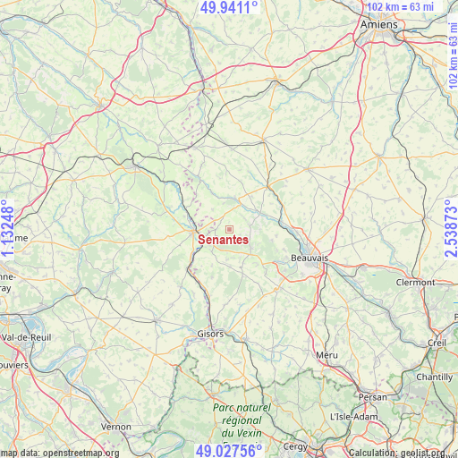
Senantes GPS coordinates[2]
49° 29' 11.256" North, 1° 50' 8.196" East
| Map corner | latitude | longitude |
|---|---|---|
| Upper-left | 49.9411°, | 1.13248° |
| Center: | 49.48646°, | 1.83561° |
| Lower-right: | 49.02756°, | 2.53873° |
| Map W x H: | 101.6×101.6 km | = 63.1×63.1mi |
| max Lat: | 51.07786° ⇑10.9% North |
| Senantes: | 49.48646° |
| min Lat: | ⇓89.1% South 41.3874° |
| min Long | Senantes | max Long |
| -5.08615° | 1.83561° | 9.52242° |
| W 41%⇐ | ⇒59% E |
Elevation
Elevation of Senantes is 180 m = 591 ft, and this is 13.7 m = 45 ft below average elevation for this country.
| Max E: |
2333 m = 7654 ft | 37.9% |
| Avg. | 193.7 m = 635 ft | |
| Senantes | 180 m = 591 ft | |
Min E: |
-1 m = -3 ft | 62.1% |
See also: France elevation on elevation.city.
Geographical zone
Senantes is located in North temperate zone (between Tropic of Cancer and the Arctic Circle). Distance of this North polar circle is 1898.8 km =1179.9 mi to North.| Distance of | km | miles | from Senantes |
|---|---|---|---|
| North Pole | 4504.7 | 2799.1 | to North |
| Arctic Circle | 1898.8 | 1179.9 | to North |
| Tropic Cancer | 2896.5 | 1799.8 | to South |
| Equator | 5502.4 | 3419 | to South |


Nearby cities:
15 places around Senantes: (largest is in red/bold)
• Boutavent
12.1 km =7.5 mi,  347°
347°
• Cuigy-en-Bray
6.7 km =4.2 mi,  185°
185°
• Gournay-en-Bray
8 km =5 mi,  267°
267°
• Hanvoile
4.3 km =2.7 mi,  51°
51°
• Herchies
12.6 km =7.8 mi,  89°
89°
• Lachapelle-aux-Pots
6.4 km =4 mi,  130°
130°
• Lalande-en-Son
11.2 km =7 mi,  199°
199°
• Le Coudray-Saint-Germer
8.3 km =5.2 mi,  178°
178°
• Milly-sur-Thérain
11.7 km =7.3 mi,  81°
81°
• Ons-en-Bray
10 km =6.2 mi,  140°
140°
• Saint-Aubin-en-Bray
7.9 km =4.9 mi,  157°
157°
• Saint-Germer-de-Fly
6.3 km =3.9 mi,  219°
219°
• Savignies
9.7 km =6 mi,  104°
104°
• Songeons
7.1 km =4.4 mi,  10°
10°
• Villers-Saint-Barthélemy
12.9 km =8 mi, 140°
Sources, notices
• [Note1] Compared only with cities in France existing in our database
• [Src1] Map data: © OpenStreetMap contributors (CC-BY-SA)
• [Src2] Other city data from geonames.org with taken over terms of usage.
• [Src3] Geographical zone / Annual Mean Temperature by Robert A. Rohde @ Wikipedia
