Le Cap d'Agde geodata
Le Cap d'Agde (Occitanie) is a populated place; located in France in Europe/Paris (GMT+2) time zone. With population of 4,600 people, there are 2148 cities with bigger population in this country. Compared to other cities in France, 96.2% of cities are located further ↑North; 64.4% of cities are located further ←West and 99.8% of cities have higher elevation than Le Cap d'Agde. Note1
Administrative division(s):
- Level 1: Occitanie
- Level 2: Département de l'Hérault
- Level 3: Arrondissement de Béziers
- Level 4: Agde


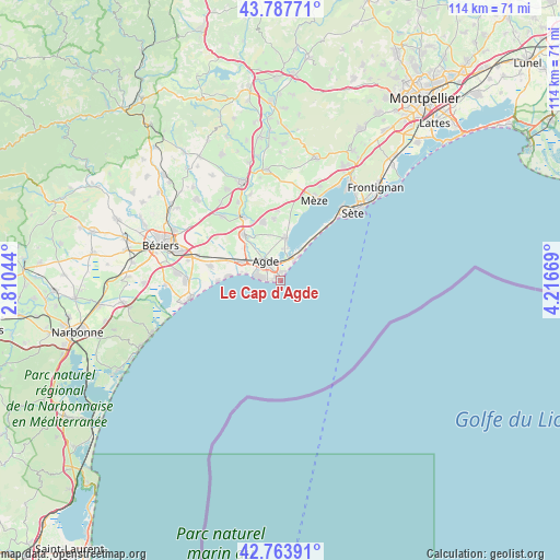
Le Cap d'Agde GPS coordinates[2]
43° 16' 40.656" North, 3° 30' 48.852" East
| Map corner | latitude | longitude |
|---|---|---|
| Upper-left | 43.78771°, | 2.81044° |
| Center: | 43.27796°, | 3.51357° |
| Lower-right: | 42.76391°, | 4.21669° |
| Map W x H: | 113.8×113.8 km | = 70.7×70.7mi |
| max Lat: | 51.07786° ⇑96.2% North |
| Le Cap d'Agde: | 43.27796° |
| min Lat: | ⇓3.8% South 41.3874° |
| min Long | Le Cap d'Agde | max Long |
| -5.08615° | 3.51357° | 9.52242° |
| W 64.4%⇐ | ⇒35.6% E |
Elevation
Elevation of Le Cap d'Agde is 3 m = 10 ft, and this is 190.7 m = 626 ft below average elevation for this country.
| Max E: |
2333 m = 7654 ft | 99.8% |
| Avg. | 193.7 m = 635 ft | |
| Le Cap d'Agde | 3 m = 10 ft | |
Min E: |
-1 m = -3 ft | 0.2% |
See also: France elevation on elevation.city.
Geographical zone
Le Cap d'Agde is located in North temperate zone (between Tropic of Cancer and the Arctic Circle). Distance of this Northern Tropic circle is 2206.1 km =1370.8 mi to South.| Distance of | km | miles | from Le Cap d'Agde |
|---|---|---|---|
| North Pole | 5195 | 3228 | to North |
| Arctic Circle | 2589.1 | 1608.8 | to North |
| Tropic Cancer | 2206.1 | 1370.8 | to South |
| Equator | 4812.1 | 2990.1 | to South |


Nearby cities:
15 places around Le Cap d'Agde: (largest is in red/bold)
• Agde
4.8 km =3 mi,  320°
320°
• Bessan
11.9 km =7.4 mi, 321°
• Castelnau-de-Guers
18.4 km =11.4 mi,  340°
340°
• Cers
17.7 km =11 mi,  286°
286°
• Florensac
12.3 km =7.6 mi, 341°
• Marseillan
8.8 km =5.5 mi,  7°
7°
• Montblanc
17.6 km =10.9 mi, 317°
• Mèze
18 km =11.2 mi,  24°
24°
• Pinet
14.2 km =8.8 mi,  358°
358°
• Pomérols
12.7 km =7.9 mi,  354°
354°
• Portiragnes
14.9 km =9.3 mi,  281°
281°
• Saint-Thibéry
15.3 km =9.5 mi,  329°
329°
• Sérignan
19.1 km =11.9 mi,  270°
270°
• Valras-Plage
18.4 km =11.4 mi,  259°
259°
• Vias
8.6 km =5.3 mi,  295°
295°
Sources, notices
• [Note1] Compared only with cities in France existing in our database
• [Src1] Map data: © OpenStreetMap contributors (CC-BY-SA)
• [Src2] Other city data from geonames.org with taken over terms of usage.
• [Src3] Geographical zone / Annual Mean Temperature by Robert A. Rohde @ Wikipedia
