La Valette-du-Var geodata
La Valette-du-Var (Provence-Alpes-Côte d'Azur) is a populated place; located in France in Europe/Paris (GMT+2) time zone. With population of 23,134 people, there are 384 cities with bigger population in this country. Compared to other cities in France, 97.7% of cities are located further ↑North; 86.9% of cities are located further ←West and 74.1% of cities have higher elevation than La Valette-du-Var. Note1
Administrative division(s):
- Level 1: Provence-Alpes-Côte d'Azur
- Level 2: Var
- Level 3: Arrondissement de Toulon
- Level 4: La Valette-du-Var


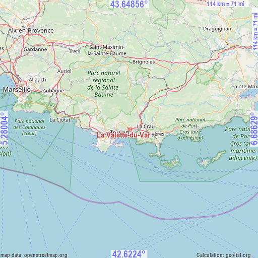
La Valette-du-Var GPS coordinates[2]
43° 8' 15.468" North, 5° 58' 59.412" East
| Map corner | latitude | longitude |
|---|---|---|
| Upper-left | 43.64856°, | 5.28004° |
| Center: | 43.13763°, | 5.98317° |
| Lower-right: | 42.6224°, | 6.68629° |
| Map W x H: | 114.1×114.1 km | = 70.9×70.9mi |
| max Lat: | 51.07786° ⇑97.7% North |
| La Valette-du-Var: | 43.13763° |
| min Lat: | ⇓2.3% South 41.3874° |
| min Long | La Valette-du-V | max Long |
| -5.08615° | 5.98317° | 9.52242° |
| W 86.9%⇐ | ⇒13.1% E |
Elevation
Elevation of La Valette-du-Var is 69 m = 226 ft, and this is 124.7 m = 409 ft below average elevation for this country.
| Max E: |
2333 m = 7654 ft | 74.1% |
| Avg. | 193.7 m = 635 ft | |
| La Valette-du-Var | 69 m = 226 ft | |
Min E: |
-1 m = -3 ft | 25.9% |
See also: France elevation on elevation.city.
Geographical zone
La Valette-du-Var is located in North temperate zone (between Tropic of Cancer and the Arctic Circle). Distance of this Northern Tropic circle is 2190.5 km =1361.1 mi to South.| Distance of | km | miles | from La Valette-du-Var |
|---|---|---|---|
| North Pole | 5210.6 | 3237.7 | to North |
| Arctic Circle | 2604.7 | 1618.5 | to North |
| Tropic Cancer | 2190.5 | 1361.1 | to South |
| Equator | 4796.5 | 2980.4 | to South |


Nearby cities:
15 places around La Valette-du-Var: (largest is in red/bold)
• Belgentier
12 km =7.5 mi,  6°
6°
• Carqueiranne
8.7 km =5.4 mi,  122°
122°
• La Crau
7.5 km =4.7 mi,  79°
79°
• La Farlède
6 km =3.7 mi,  54°
54°
• La Garde
2.6 km =1.6 mi, 123°
• La Seyne-sur-Mer
9.3 km =5.8 mi,  245°
245°
• Le Pradet
4.8 km =3 mi,  137°
137°
• Le Revest-les-Eaux
6.3 km =3.9 mi,  313°
313°
• Ollioules
11 km =6.8 mi,  271°
271°
• Saint-Mandrier-sur-Mer
8 km =5 mi,  213°
213°
• Solliès-Pont
7.5 km =4.7 mi,  38°
38°
• Solliès-Toucas
8.3 km =5.2 mi,  24°
24°
• Solliès-Ville
6.7 km =4.2 mi, 41°
• Toulon
4.7 km =2.9 mi, 251°
• Évenos
11.5 km =7.1 mi,  284°
284°
Sources, notices
• [Note1] Compared only with cities in France existing in our database
• [Src1] Map data: © OpenStreetMap contributors (CC-BY-SA)
• [Src2] Other city data from geonames.org with taken over terms of usage.
• [Src3] Geographical zone / Annual Mean Temperature by Robert A. Rohde @ Wikipedia
