Belgentier geodata
Belgentier (Provence-Alpes-Côte d'Azur) is a populated place; located in France in Europe/Paris (GMT+2) time zone. With population of 1,867 people, there are 5090 cities with bigger population in this country. Compared to other cities in France, 96.7% of cities are located further ↑North; 87% of cities are located further ←West and 64.6% of cities have lower elevation than Belgentier. Note1
Administrative division(s):
- Level 1: Provence-Alpes-Côte d'Azur
- Level 2: Var
- Level 3: Arrondissement de Toulon
- Level 4: Belgentier


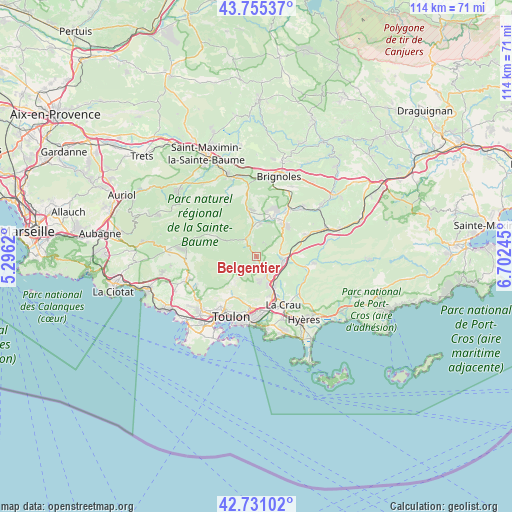
Belgentier GPS coordinates[2]
43° 14' 43.26" North, 5° 59' 57.588" East
| Map corner | latitude | longitude |
|---|---|---|
| Upper-left | 43.75537°, | 5.2962° |
| Center: | 43.24535°, | 5.99933° |
| Lower-right: | 42.73102°, | 6.70245° |
| Map W x H: | 113.9×113.9 km | = 70.8×70.8mi |
| max Lat: | 51.07786° ⇑96.7% North |
| Belgentier: | 43.24535° |
| min Lat: | ⇓3.3% South 41.3874° |
| min Long | Belgentier | max Long |
| -5.08615° | 5.99933° | 9.52242° |
| W 87%⇐ | ⇒13% E |
Elevation
Elevation of Belgentier is 192 m = 630 ft, and this is 1.7 m = 6 ft below average elevation for this country.
| Max E: |
2333 m = 7654 ft | 35.4% |
| Avg. | 193.7 m = 635 ft | |
| Belgentier | 192 m = 630 ft | |
Min E: |
-1 m = -3 ft | 64.6% |
See also: France elevation on elevation.city.
Geographical zone
Belgentier is located in North temperate zone (between Tropic of Cancer and the Arctic Circle). Distance of this Northern Tropic circle is 2202.5 km =1368.6 mi to South.| Distance of | km | miles | from Belgentier |
|---|---|---|---|
| North Pole | 5198.6 | 3230.3 | to North |
| Arctic Circle | 2592.7 | 1611 | to North |
| Tropic Cancer | 2202.5 | 1368.6 | to South |
| Equator | 4808.4 | 2987.8 | to South |


Nearby cities:
15 places around Belgentier: (largest is in red/bold)
• Cuers
5.9 km =3.7 mi,  98°
98°
• Forcalqueiret
12.2 km =7.6 mi,  33°
33°
• Garéoult
10 km =6.2 mi,  22°
22°
• La Farlède
9.2 km =5.7 mi,  157°
157°
• La Roquebrussanne
10.7 km =6.6 mi,  349°
349°
• La Valette-du-Var
12 km =7.5 mi,  186°
186°
• Le Revest-les-Eaux
9.7 km =6 mi,  217°
217°
• Méounes-lès-Montrieux
4.6 km =2.9 mi,  328°
328°
• Néoules
7 km =4.3 mi,  5°
5°
• Pierrefeu-du-Var
12.1 km =7.5 mi, 101°
• Puget-Ville
12.1 km =7.5 mi,  66°
66°
• Rocbaron
9.6 km =6 mi,  42°
42°
• Solliès-Pont
7 km =4.3 mi,  151°
151°
• Solliès-Toucas
4.9 km =3 mi, 154°
• Solliès-Ville
7.7 km =4.8 mi, 155°
Sources, notices
• [Note1] Compared only with cities in France existing in our database
• [Src1] Map data: © OpenStreetMap contributors (CC-BY-SA)
• [Src2] Other city data from geonames.org with taken over terms of usage.
• [Src3] Geographical zone / Annual Mean Temperature by Robert A. Rohde @ Wikipedia
