Lasbordes geodata
Lasbordes (Occitanie) is a populated place; located in France in Europe/Paris (GMT+2) time zone. With population of 784 people, there are 10781 cities with bigger population in this country. Compared to other cities in France, 95.8% of cities are located further ↑North; 56.5% of cities are located further →East and 57.4% of cities have lower elevation than Lasbordes. Note1
Administrative division(s):
- Level 1: Occitanie
- Level 2: Département de l'Aude
- Level 3: Arrondissement de Carcassonne
- Level 4: Lasbordes


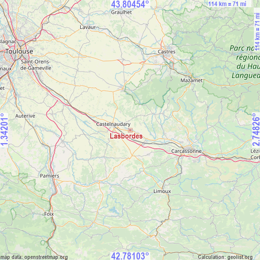
Lasbordes GPS coordinates[2]
43° 17' 41.784" North, 2° 2' 42.468" East
| Map corner | latitude | longitude |
|---|---|---|
| Upper-left | 43.80454°, | 1.34201° |
| Center: | 43.29494°, | 2.04513° |
| Lower-right: | 42.78103°, | 2.74826° |
| Map W x H: | 113.8×113.8 km | = 70.7×70.7mi |
| max Lat: | 51.07786° ⇑95.8% North |
| Lasbordes: | 43.29494° |
| min Lat: | ⇓4.2% South 41.3874° |
| min Long | Lasbordes | max Long |
| -5.08615° | 2.04513° | 9.52242° |
| W 43.5%⇐ | ⇒56.5% E |
Elevation
Elevation of Lasbordes is 159 m = 522 ft, and this is 34.7 m = 114 ft below average elevation for this country.
| Max E: |
2333 m = 7654 ft | 42.6% |
| Avg. | 193.7 m = 635 ft | |
| Lasbordes | 159 m = 522 ft | |
Min E: |
-1 m = -3 ft | 57.4% |
See also: France elevation on elevation.city.
Geographical zone
Lasbordes is located in North temperate zone (between Tropic of Cancer and the Arctic Circle). Distance of this Northern Tropic circle is 2208 km =1372 mi to South.| Distance of | km | miles | from Lasbordes |
|---|---|---|---|
| North Pole | 5193.1 | 3226.8 | to North |
| Arctic Circle | 2587.2 | 1607.6 | to North |
| Tropic Cancer | 2208 | 1372 | to South |
| Equator | 4813.9 | 2991.2 | to South |


Nearby cities:
15 places around Lasbordes: (largest is in red/bold)
• Alzonne
11.7 km =7.3 mi,  113°
113°
• Bram
7.9 km =4.9 mi,  135°
135°
• Castelnaudary
7.8 km =4.8 mi,  289°
289°
• Fanjeaux
12.1 km =7.5 mi,  184°
184°
• Mas-Saintes-Puelles
13.7 km =8.5 mi,  278°
278°
• Montolieu
13.9 km =8.6 mi,  82°
82°
• Montréal
13.1 km =8.1 mi, 143°
• Moussoulens
15.2 km =9.4 mi,  96°
96°
• Pexiora
3 km =1.9 mi,  193°
193°
• Saint-Martin-Lalande
2.1 km =1.3 mi, 283°
• Saint-Papoul
4 km =2.5 mi,  349°
349°
• Saissac
12.4 km =7.7 mi,  53°
53°
• Villasavary
8.3 km =5.2 mi, 182°
• Villeneuve-la-Comptal
10.3 km =6.4 mi,  265°
265°
• Villepinte
3.7 km =2.3 mi, 112°
Sources, notices
• [Note1] Compared only with cities in France existing in our database
• [Src1] Map data: © OpenStreetMap contributors (CC-BY-SA)
• [Src2] Other city data from geonames.org with taken over terms of usage.
• [Src3] Geographical zone / Annual Mean Temperature by Robert A. Rohde @ Wikipedia
