La Forest-Landerneau geodata
La Forest-Landerneau (Brittany) is a populated place; located in France in Europe/Paris (GMT+2) time zone. With population of 1,686 people, there are 5559 cities with bigger population in this country. Compared to other cities in France, 66.8% of cities are located further ↓South; 99.5% of cities are located further →East and 86.7% of cities have higher elevation than La Forest-Landerneau. Note1
Administrative division(s):
- Level 1: Brittany
- Level 2: Département du Finistère
- Level 3: Arrondissement de Brest
- Level 4: La Forest-Landerneau
Current local time in La Forest-Landerneau:
05:55 AM, WednesdayDifference from your time zone: hours


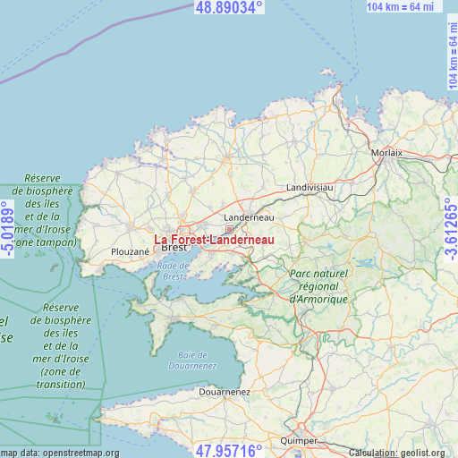
La Forest-Landerneau GPS coordinates[2]
48° 25' 33.204" North, 4° 18' 56.808" West
| Map corner | latitude | longitude |
|---|---|---|
| Upper-left | 48.89034°, | -5.0189° |
| Center: | 48.42589°, | -4.31578° |
| Lower-right: | 47.95716°, | -3.61265° |
| Map W x H: | 103.8×103.8 km | = 64.5×64.5mi |
| max Lat: | 51.07786° ⇑33.2% North |
| La Forest-Landerneau: | 48.42589° |
| min Lat: | ⇓66.8% South 41.3874° |
| min Long | La Forest-Lande | max Long |
| -5.08615° | -4.31578° | 9.52242° |
| W 0.5%⇐ | ⇒99.5% E |
Elevation
Elevation of La Forest-Landerneau is 38 m = 125 ft, and this is 155.7 m = 511 ft below average elevation for this country.
| Max E: |
2333 m = 7654 ft | 86.7% |
| Avg. | 193.7 m = 635 ft | |
| La Forest-Landerneau | 38 m = 125 ft | |
Min E: |
-1 m = -3 ft | 13.3% |
See also: France elevation on elevation.city.
Geographical zone
La Forest-Landerneau is located in North temperate zone (between Tropic of Cancer and the Arctic Circle). Distance of this North polar circle is 2016.7 km =1253.1 mi to North.| Distance of | km | miles | from La Forest-Landerneau |
|---|---|---|---|
| North Pole | 4622.6 | 2872.3 | to North |
| Arctic Circle | 2016.7 | 1253.1 | to North |
| Tropic Cancer | 2778.5 | 1726.5 | to South |
| Equator | 5384.5 | 3345.8 | to South |


Nearby cities:
15 places around La Forest-Landerneau: (largest is in red/bold)
• Daoulas
8.3 km =5.2 mi,  150°
150°
• Dirinon
4.6 km =2.9 mi,  132°
132°
• Gouesnou
11.4 km =7.1 mi,  285°
285°
• Guipavas
6.1 km =3.8 mi,  279°
279°
• Irvillac
9.8 km =6.1 mi, 129°
• Kersaint-Plabennec
6.6 km =4.1 mi,  320°
320°
• La Roche-Maurice
10 km =6.2 mi,  57°
57°
• Landerneau
5.5 km =3.4 mi, 57°
• Le Relecq-Kerhuon
6.1 km =3.8 mi,  249°
249°
• Loperhet
5.5 km =3.4 mi,  172°
172°
• Pencran
6.1 km =3.8 mi,  82°
82°
• Plougastel-Daoulas
7.6 km =4.7 mi,  209°
209°
• Plouédern
8 km =5 mi,  37°
37°
• Saint-Thonan
6.5 km =4 mi,  348°
348°
• Saint-Urbain
6.7 km =4.2 mi,  115°
115°
Sources, notices
• [Note1] Compared only with cities in France existing in our database
• [Src1] Map data: © OpenStreetMap contributors (CC-BY-SA)
• [Src2] Other city data from geonames.org with taken over terms of usage.
• [Src3] Geographical zone / Annual Mean Temperature by Robert A. Rohde @ Wikipedia
