Beauzac geodata
Beauzac (Auvergne-Rhône-Alpes) is a populated place; located in France in Europe/Paris (GMT+2) time zone. With population of 2,162 people, there are 4445 cities with bigger population in this country. Compared to other cities in France, 76.8% of cities are located further ↑North; 68.8% of cities are located further ←West and 94.3% of cities have lower elevation than Beauzac. Note1
Administrative division(s):
- Level 1: Auvergne-Rhône-Alpes
- Level 2: Haute-Loire
- Level 3: Yssingeaux
- Level 4: Beauzac


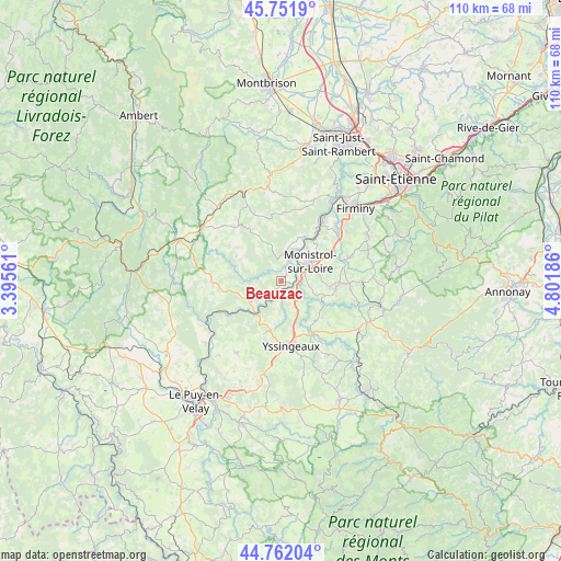
Beauzac GPS coordinates[2]
45° 15' 32.868" North, 4° 5' 55.464" East
| Map corner | latitude | longitude |
|---|---|---|
| Upper-left | 45.7519°, | 3.39561° |
| Center: | 45.25913°, | 4.09874° |
| Lower-right: | 44.76204°, | 4.80186° |
| Map W x H: | 110.1×110.1 km | = 68.4×68.4mi |
| max Lat: | 51.07786° ⇑76.8% North |
| Beauzac: | 45.25913° |
| min Lat: | ⇓23.2% South 41.3874° |
| min Long | Beauzac | max Long |
| -5.08615° | 4.09874° | 9.52242° |
| W 68.8%⇐ | ⇒31.2% E |
Elevation
Elevation of Beauzac is 554 m = 1818 ft, and this is 360.3 m = 1182 ft above average elevation for this country.
| Max E: |
2333 m = 7654 ft | 5.7% |
| Beauzac | 554 m 1818 ft | |
| Avg. | 193.7 m = 635 ft | |
Min E: |
-1 m = -3 ft | 94.3% |
See also: France elevation on elevation.city.
Geographical zone
Beauzac is located in North temperate zone (between Tropic of Cancer and the Arctic Circle). Distance of this North polar circle is 2368.8 km =1471.9 mi to North.| Distance of | km | miles | from Beauzac |
|---|---|---|---|
| North Pole | 4974.7 | 3091.1 | to North |
| Arctic Circle | 2368.8 | 1471.9 | to North |
| Tropic Cancer | 2426.4 | 1507.7 | to South |
| Equator | 5032.3 | 3126.9 | to South |


Nearby cities:
15 places around Beauzac: (largest is in red/bold)
• Aurec-sur-Loire
14.6 km =9.1 mi,  33°
33°
• Bas-en-Basset
5.3 km =3.3 mi,  8°
8°
• Beaux
8 km =5 mi,  183°
183°
• La Séauve-sur-Semène
12.5 km =7.8 mi,  71°
71°
• Lapte
12.3 km =7.6 mi,  131°
131°
• Les Villettes
7.1 km =4.4 mi,  112°
112°
• Monistrol-sur-Loire
6.9 km =4.3 mi,  57°
57°
• Pont-Salomon
14.6 km =9.1 mi,  53°
53°
• Retournac
8 km =5 mi,  219°
219°
• Saint-Didier-en-Velay
14.6 km =9.1 mi, 70°
• Saint-Maurice-de-Lignon
5 km =3.1 mi,  140°
140°
• Saint-Nizier-de-Fornas
16.1 km =10 mi,  355°
355°
• Saint-Pal-de-Mons
13.8 km =8.6 mi,  95°
95°
• Sainte-Sigolène
10.7 km =6.6 mi, 99°
• Yssingeaux
13.1 km =8.1 mi,  171°
171°
Sources, notices
• [Note1] Compared only with cities in France existing in our database
• [Src1] Map data: © OpenStreetMap contributors (CC-BY-SA)
• [Src2] Other city data from geonames.org with taken over terms of usage.
• [Src3] Geographical zone / Annual Mean Temperature by Robert A. Rohde @ Wikipedia
