Guitté geodata
Guitté (Brittany) is a populated place; located in France in Europe/Paris (GMT+2) time zone. With population of 549 people, there are 14229 cities with bigger population in this country. Compared to other cities in France, 64.5% of cities are located further ↓South; 95.2% of cities are located further →East and 67.8% of cities have higher elevation than Guitté. Note1
Administrative division(s):
- Level 1: Brittany
- Level 2: Département des Côtes-d’Armor
- Level 3: Arrondissement de Dinan
- Level 4: Guitté


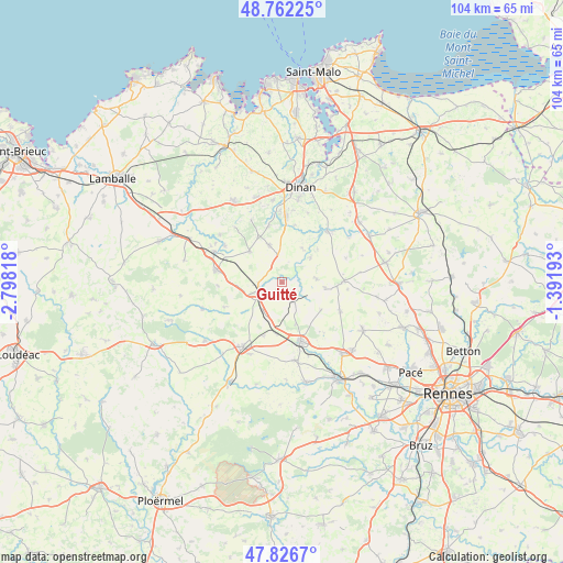
Guitté GPS coordinates[2]
48° 17' 47.832" North, 2° 5' 42.216" West
| Map corner | latitude | longitude |
|---|---|---|
| Upper-left | 48.76225°, | -2.79818° |
| Center: | 48.29662°, | -2.09506° |
| Lower-right: | 47.8267°, | -1.39193° |
| Map W x H: | 104×104 km | = 64.6×64.6mi |
| max Lat: | 51.07786° ⇑35.5% North |
| Guitté: | 48.29662° |
| min Lat: | ⇓64.5% South 41.3874° |
| min Long | Guitté | max Long |
| -5.08615° | -2.09506° | 9.52242° |
| W 4.8%⇐ | ⇒95.2% E |
Elevation
Elevation of Guitté is 83 m = 272 ft, and this is 110.7 m = 363 ft below average elevation for this country.
| Max E: |
2333 m = 7654 ft | 67.8% |
| Avg. | 193.7 m = 635 ft | |
| Guitté | 83 m = 272 ft | |
Min E: |
-1 m = -3 ft | 32.2% |
See also: France elevation on elevation.city.
Geographical zone
Guitté is located in North temperate zone (between Tropic of Cancer and the Arctic Circle). Distance of this North polar circle is 2031.1 km =1262.1 mi to North.| Distance of | km | miles | from Guitté |
|---|---|---|---|
| North Pole | 4637 | 2881.3 | to North |
| Arctic Circle | 2031.1 | 1262.1 | to North |
| Tropic Cancer | 2764.2 | 1717.6 | to South |
| Equator | 5370.1 | 3336.8 | to South |


Nearby cities:
15 places around Guitté: (largest is in red/bold)
• Brusvily
10.7 km =6.6 mi,  346°
346°
• Bécherel
11.1 km =6.9 mi,  90°
90°
• Caulnes
4.5 km =2.8 mi,  257°
257°
• Landujan
8.9 km =5.5 mi,  124°
124°
• Le Hinglé
10.8 km =6.7 mi,  6°
6°
• Montauban-de-Bretagne
11.4 km =7.1 mi,  161°
161°
• Médréac
3.9 km =2.4 mi,  146°
146°
• Plouasne
6.5 km =4 mi, 85°
• Plumaudan
7.1 km =4.4 mi,  342°
342°
• Plumaugat
11.6 km =7.2 mi,  246°
246°
• Quédillac
6.3 km =3.9 mi,  213°
213°
• Saint-Juvat
7.4 km =4.6 mi,  30°
30°
• Saint-Pern
8.1 km =5 mi,  97°
97°
• Trévron
10.8 km =6.7 mi, 12°
• Yvignac-la-Tour
8.8 km =5.5 mi,  312°
312°
Sources, notices
• [Note1] Compared only with cities in France existing in our database
• [Src1] Map data: © OpenStreetMap contributors (CC-BY-SA)
• [Src2] Other city data from geonames.org with taken over terms of usage.
• [Src3] Geographical zone / Annual Mean Temperature by Robert A. Rohde @ Wikipedia
