Trieux geodata
Trieux (Grand Est) is a populated place; located in France in Europe/Paris (GMT+2) time zone. With population of 1,977 people, there are 4837 cities with bigger population in this country. Compared to other cities in France, 86.5% of cities are located further ↓South; 86.3% of cities are located further ←West and 80.1% of cities have lower elevation than Trieux. Note1
Administrative division(s):
- Level 1: Grand Est
- Level 2: Meurthe-et-Moselle
- Level 3: Arrondissement de Briey
- Level 4: Trieux


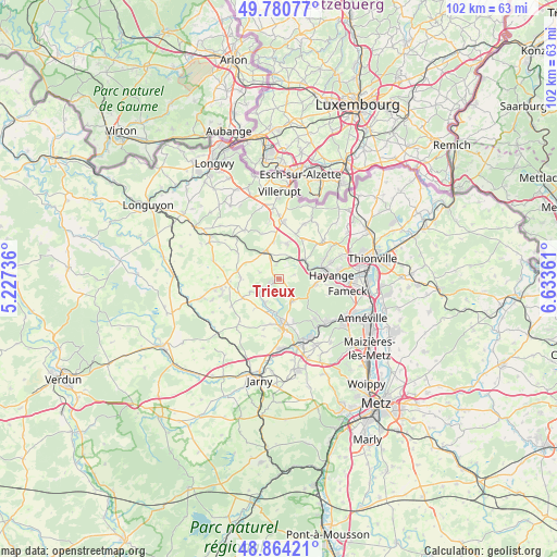
Trieux GPS coordinates[2]
49° 19' 28.632" North, 5° 55' 49.764" East
| Map corner | latitude | longitude |
|---|---|---|
| Upper-left | 49.78077°, | 5.22736° |
| Center: | 49.32462°, | 5.93049° |
| Lower-right: | 48.86421°, | 6.63361° |
| Map W x H: | 101.9×101.9 km | = 63.3×63.3mi |
| max Lat: | 51.07786° ⇑13.5% North |
| Trieux: | 49.32462° |
| min Lat: | ⇓86.5% South 41.3874° |
| min Long | Trieux | max Long |
| -5.08615° | 5.93049° | 9.52242° |
| W 86.3%⇐ | ⇒13.7% E |
Elevation
Elevation of Trieux is 291 m = 955 ft, and this is 97.3 m = 319 ft above average elevation for this country.
| Max E: |
2333 m = 7654 ft | 19.9% |
| Trieux | 291 m 955 ft | |
| Avg. | 193.7 m = 635 ft | |
Min E: |
-1 m = -3 ft | 80.1% |
See also: France elevation on elevation.city.
Geographical zone
Trieux is located in North temperate zone (between Tropic of Cancer and the Arctic Circle). Distance of this North polar circle is 1916.8 km =1191 mi to North.| Distance of | km | miles | from Trieux |
|---|---|---|---|
| North Pole | 4522.7 | 2810.3 | to North |
| Arctic Circle | 1916.8 | 1191 | to North |
| Tropic Cancer | 2878.5 | 1788.6 | to South |
| Equator | 5484.4 | 3407.8 | to South |


Nearby cities:
15 places around Trieux: (largest is in red/bold)
• Audun-le-Roman
5.6 km =3.5 mi,  333°
333°
• Avril
4.8 km =3 mi,  148°
148°
• Boulange
6.6 km =4.1 mi,  12°
12°
• Briey
8.4 km =5.2 mi,  175°
175°
• Fontoy
5.7 km =3.5 mi,  52°
52°
• Knutange
8 km =5 mi,  78°
78°
• Lantéfontaine
8.6 km =5.3 mi,  192°
192°
• Mance
6.3 km =3.9 mi, 189°
• Mancieulles
5.3 km =3.3 mi,  207°
207°
• Mont-Bonvillers
6.9 km =4.3 mi,  272°
272°
• Moyeuvre-Petite
9.2 km =5.7 mi,  131°
131°
• Neufchef
6.8 km =4.2 mi,  97°
97°
• Nilvange
8.9 km =5.5 mi, 77°
• Serrouville
8.8 km =5.5 mi,  339°
339°
• Tucquegnieux
3.1 km =1.9 mi,  238°
238°
Sources, notices
• [Note1] Compared only with cities in France existing in our database
• [Src1] Map data: © OpenStreetMap contributors (CC-BY-SA)
• [Src2] Other city data from geonames.org with taken over terms of usage.
• [Src3] Geographical zone / Annual Mean Temperature by Robert A. Rohde @ Wikipedia
