Avril geodata
Avril (Grand Est) is a populated place; located in France in Europe/Paris (GMT+2) time zone. With population of 608 people, there are 13192 cities with bigger population in this country. Compared to other cities in France, 85.8% of cities are located further ↓South; 86.7% of cities are located further ←West and 81.2% of cities have lower elevation than Avril. Note1
Administrative division(s):
- Level 1: Grand Est
- Level 2: Meurthe-et-Moselle
- Level 3: Arrondissement de Briey
- Level 4: Avril


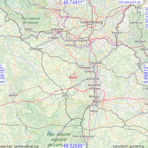
Avril GPS coordinates[2]
49° 17' 15.432" North, 5° 57' 53.964" East
| Map corner | latitude | longitude |
|---|---|---|
| Upper-left | 49.74411°, | 5.26187° |
| Center: | 49.28762°, | 5.96499° |
| Lower-right: | 48.82686°, | 6.66812° |
| Map W x H: | 102×102 km | = 63.4×63.4mi |
| max Lat: | 51.07786° ⇑14.2% North |
| Avril: | 49.28762° |
| min Lat: | ⇓85.8% South 41.3874° |
| min Long | Avril | max Long |
| -5.08615° | 5.96499° | 9.52242° |
| W 86.7%⇐ | ⇒13.3% E |
Elevation
Elevation of Avril is 302 m = 991 ft, and this is 108.3 m = 355 ft above average elevation for this country.
| Max E: |
2333 m = 7654 ft | 18.8% |
| Avril | 302 m 991 ft | |
| Avg. | 193.7 m = 635 ft | |
Min E: |
-1 m = -3 ft | 81.2% |
See also: France elevation on elevation.city.
Geographical zone
Avril is located in North temperate zone (between Tropic of Cancer and the Arctic Circle). Distance of this North polar circle is 1920.9 km =1193.6 mi to North.| Distance of | km | miles | from Avril |
|---|---|---|---|
| North Pole | 4526.8 | 2812.8 | to North |
| Arctic Circle | 1920.9 | 1193.6 | to North |
| Tropic Cancer | 2874.4 | 1786.1 | to South |
| Equator | 5480.3 | 3405.3 | to South |


Nearby cities:
15 places around Avril: (largest is in red/bold)
• Briey
4.6 km =2.9 mi,  203°
203°
• Fontoy
7.9 km =4.9 mi,  14°
14°
• Homécourt
7.7 km =4.8 mi,  165°
165°
• Jœuf
7.1 km =4.4 mi,  148°
148°
• Knutange
7.8 km =4.8 mi,  43°
43°
• Lantéfontaine
6.1 km =3.8 mi,  225°
225°
• Mance
4.1 km =2.5 mi,  238°
238°
• Mancieulles
5 km =3.1 mi,  263°
263°
• Moutiers
6.1 km =3.8 mi,  179°
179°
• Moyeuvre-Grande
6.9 km =4.3 mi,  123°
123°
• Moyeuvre-Petite
4.8 km =3 mi,  113°
113°
• Neufchef
5.4 km =3.4 mi,  52°
52°
• Ranguevaux
6.6 km =4.1 mi,  80°
80°
• Trieux
4.8 km =3 mi,  328°
328°
• Tucquegnieux
5.7 km =3.5 mi,  296°
296°
Sources, notices
• [Note1] Compared only with cities in France existing in our database
• [Src1] Map data: © OpenStreetMap contributors (CC-BY-SA)
• [Src2] Other city data from geonames.org with taken over terms of usage.
• [Src3] Geographical zone / Annual Mean Temperature by Robert A. Rohde @ Wikipedia
