Montaudin geodata
Montaudin (Pays de la Loire) is a populated place; located in France in Europe/Paris (GMT+2) time zone. With population of 959 people, there are 9134 cities with bigger population in this country. Compared to other cities in France, 66.1% of cities are located further ↓South; 88.1% of cities are located further →East and 61.9% of cities have lower elevation than Montaudin. Note1
Administrative division(s):
- Level 1: Pays de la Loire
- Level 2: Mayenne
- Level 3: Arrondissement de Mayenne
- Level 4: Montaudin


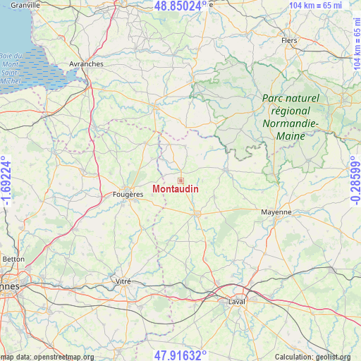
Montaudin GPS coordinates[2]
48° 23' 7.512" North, 0° 59' 20.796" West
| Map corner | latitude | longitude |
|---|---|---|
| Upper-left | 48.85024°, | -1.69224° |
| Center: | 48.38542°, | -0.98911° |
| Lower-right: | 47.91632°, | -0.28599° |
| Map W x H: | 103.8×103.8 km | = 64.5×64.5mi |
| max Lat: | 51.07786° ⇑33.9% North |
| Montaudin: | 48.38542° |
| min Lat: | ⇓66.1% South 41.3874° |
| min Long | Montaudin | max Long |
| -5.08615° | -0.98911° | 9.52242° |
| W 11.9%⇐ | ⇒88.1% E |
Elevation
Elevation of Montaudin is 179 m = 587 ft, and this is 14.7 m = 48 ft below average elevation for this country.
| Max E: |
2333 m = 7654 ft | 38.1% |
| Avg. | 193.7 m = 635 ft | |
| Montaudin | 179 m = 587 ft | |
Min E: |
-1 m = -3 ft | 61.9% |
See also: France elevation on elevation.city.
Geographical zone
Montaudin is located in North temperate zone (between Tropic of Cancer and the Arctic Circle). Distance of this North polar circle is 2021.2 km =1255.9 mi to North.| Distance of | km | miles | from Montaudin |
|---|---|---|---|
| North Pole | 4627.1 | 2875.1 | to North |
| Arctic Circle | 2021.2 | 1255.9 | to North |
| Tropic Cancer | 2774 | 1723.7 | to South |
| Equator | 5380 | 3343 | to South |


Nearby cities:
15 places around Montaudin: (largest is in red/bold)
• Colombiers-du-Plessis
11 km =6.8 mi,  86°
86°
• Désertines
12.9 km =8 mi,  44°
44°
• Ernée
10.7 km =6.6 mi,  156°
156°
• Fleurigné
11.3 km =7 mi,  240°
240°
• Fougerolles-du-Plessis
10 km =6.2 mi,  7°
7°
• La Chapelle-Janson
9.3 km =5.8 mi, 243°
• Laignelet
12.1 km =7.5 mi,  261°
261°
• Landivy
10.9 km =6.8 mi,  342°
342°
• Landéan
12.4 km =7.7 mi,  284°
284°
• Larchamp
2.8 km =1.7 mi,  195°
195°
• Le Loroux
5.7 km =3.5 mi, 280°
• Pontmain
8.1 km =5 mi,  317°
317°
• Saint-Denis-de-Gastines
10.8 km =6.7 mi,  116°
116°
• Saint-Mars-sur-la-Futaie
5.5 km =3.4 mi, 339°
• Saint-Pierre-des-Landes
12.7 km =7.9 mi,  193°
193°
Sources, notices
• [Note1] Compared only with cities in France existing in our database
• [Src1] Map data: © OpenStreetMap contributors (CC-BY-SA)
• [Src2] Other city data from geonames.org with taken over terms of usage.
• [Src3] Geographical zone / Annual Mean Temperature by Robert A. Rohde @ Wikipedia
