Landiras geodata
Landiras (Nouvelle-Aquitaine) is a populated place; located in France in Europe/Paris (GMT+2) time zone. With population of 1,642 people, there are 5686 cities with bigger population in this country. Compared to other cities in France, 83% of cities are located further ↑North; 82.3% of cities are located further →East and 84.9% of cities have higher elevation than Landiras. Note1
Administrative division(s):
- Level 1: Nouvelle-Aquitaine
- Level 2: Gironde
- Level 3: Arrondissement de Langon
- Level 4: Landiras


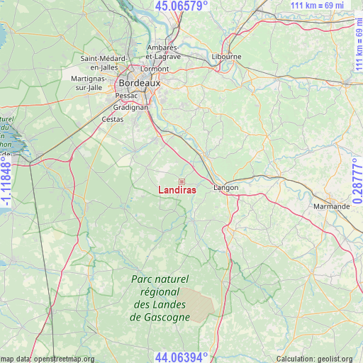
Landiras GPS coordinates[2]
44° 34' 1.272" North, 0° 24' 55.296" West
| Map corner | latitude | longitude |
|---|---|---|
| Upper-left | 45.06579°, | -1.11848° |
| Center: | 44.56702°, | -0.41536° |
| Lower-right: | 44.06394°, | 0.28777° |
| Map W x H: | 111.4×111.4 km | = 69.2×69.2mi |
| max Lat: | 51.07786° ⇑83% North |
| Landiras: | 44.56702° |
| min Lat: | ⇓17% South 41.3874° |
| min Long | Landiras | max Long |
| -5.08615° | -0.41536° | 9.52242° |
| W 17.7%⇐ | ⇒82.3% E |
Elevation
Elevation of Landiras is 42 m = 138 ft, and this is 151.7 m = 498 ft below average elevation for this country.
| Max E: |
2333 m = 7654 ft | 84.9% |
| Avg. | 193.7 m = 635 ft | |
| Landiras | 42 m = 138 ft | |
Min E: |
-1 m = -3 ft | 15.1% |
See also: France elevation on elevation.city.
Geographical zone
Landiras is located in North temperate zone (between Tropic of Cancer and the Arctic Circle). Distance of this Northern Tropic circle is 2349.5 km =1459.9 mi to South.| Distance of | km | miles | from Landiras |
|---|---|---|---|
| North Pole | 5051.7 | 3139 | to North |
| Arctic Circle | 2445.8 | 1519.7 | to North |
| Tropic Cancer | 2349.5 | 1459.9 | to South |
| Equator | 4955.4 | 3079.1 | to South |


Nearby cities:
15 places around Landiras: (largest is in red/bold)
• Barsac
9.1 km =5.7 mi,  60°
60°
• Bommes
5.3 km =3.3 mi,  115°
115°
• Budos
4.3 km =2.7 mi,  148°
148°
• Béguey
11.2 km =7 mi,  41°
41°
• Cadillac
11 km =6.8 mi,  45°
45°
• Cérons
10 km =6.2 mi, 40°
• Illats
4.8 km =3 mi, 45°
• Loupiac
10.7 km =6.6 mi, 58°
• Léogeats
7.2 km =4.5 mi, 147°
• Noaillan
10.4 km =6.5 mi,  158°
158°
• Podensac
10.4 km =6.5 mi,  27°
27°
• Preignac
9.8 km =6.1 mi,  78°
78°
• Pujols-sur-Ciron
4.7 km =2.9 mi,  99°
99°
• Saint-Michel-de-Rieufret
6.4 km =4 mi,  346°
346°
• Sauternes
6.9 km =4.3 mi, 123°
Sources, notices
• [Note1] Compared only with cities in France existing in our database
• [Src1] Map data: © OpenStreetMap contributors (CC-BY-SA)
• [Src2] Other city data from geonames.org with taken over terms of usage.
• [Src3] Geographical zone / Annual Mean Temperature by Robert A. Rohde @ Wikipedia
