Bommes geodata
Bommes (Nouvelle-Aquitaine) is a populated place; located in France in Europe/Paris (GMT+2) time zone. With population of 569 people, there are 13839 cities with bigger population in this country. Compared to other cities in France, 83.3% of cities are located further ↑North; 81.5% of cities are located further →East and 91.2% of cities have higher elevation than Bommes. Note1
Administrative division(s):
- Level 1: Nouvelle-Aquitaine
- Level 2: Gironde
- Level 3: Arrondissement de Langon
- Level 4: Bommes


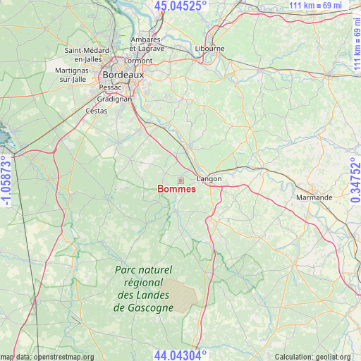
Bommes GPS coordinates[2]
44° 32' 46.68" North, 0° 21' 20.16" West
| Map corner | latitude | longitude |
|---|---|---|
| Upper-left | 45.04525°, | -1.05873° |
| Center: | 44.5463°, | -0.3556° |
| Lower-right: | 44.04304°, | 0.34752° |
| Map W x H: | 111.4×111.4 km | = 69.2×69.2mi |
| max Lat: | 51.07786° ⇑83.3% North |
| Bommes: | 44.5463° |
| min Lat: | ⇓16.7% South 41.3874° |
| min Long | Bommes | max Long |
| -5.08615° | -0.3556° | 9.52242° |
| W 18.5%⇐ | ⇒81.5% E |
Elevation
Elevation of Bommes is 27 m = 89 ft, and this is 166.7 m = 547 ft below average elevation for this country.
| Max E: |
2333 m = 7654 ft | 91.2% |
| Avg. | 193.7 m = 635 ft | |
| Bommes | 27 m = 89 ft | |
Min E: |
-1 m = -3 ft | 8.8% |
See also: France elevation on elevation.city.
Geographical zone
Bommes is located in North temperate zone (between Tropic of Cancer and the Arctic Circle). Distance of this Northern Tropic circle is 2347.2 km =1458.5 mi to South.| Distance of | km | miles | from Bommes |
|---|---|---|---|
| North Pole | 5054 | 3140.4 | to North |
| Arctic Circle | 2448.1 | 1521.2 | to North |
| Tropic Cancer | 2347.2 | 1458.5 | to South |
| Equator | 4953.1 | 3077.7 | to South |


Nearby cities:
15 places around Bommes: (largest is in red/bold)
• Barsac
7.5 km =4.7 mi,  25°
25°
• Budos
2.8 km =1.7 mi,  240°
240°
• Illats
5.8 km =3.6 mi,  346°
346°
• Landiras
5.3 km =3.3 mi,  295°
295°
• Langon
8.4 km =5.2 mi,  84°
84°
• Loupiac
9 km =5.6 mi, 29°
• Léogeats
3.9 km =2.4 mi,  192°
192°
• Noaillan
7.4 km =4.6 mi, 186°
• Preignac
6.4 km =4 mi,  48°
48°
• Pujols-sur-Ciron
1.6 km =1 mi,  357°
357°
• Roaillan
7.9 km =4.9 mi,  132°
132°
• Saint-Maixant
8.4 km =5.2 mi,  64°
64°
• Sainte-Croix-du-Mont
8.5 km =5.3 mi, 51°
• Sauternes
1.8 km =1.1 mi,  144°
144°
• Toulenne
7.4 km =4.6 mi, 81°
Sources, notices
• [Note1] Compared only with cities in France existing in our database
• [Src1] Map data: © OpenStreetMap contributors (CC-BY-SA)
• [Src2] Other city data from geonames.org with taken over terms of usage.
• [Src3] Geographical zone / Annual Mean Temperature by Robert A. Rohde @ Wikipedia
