La Motte-Saint-Jean geodata
La Motte-Saint-Jean (Bourgogne-Franche-Comté) is a populated place; located in France in Europe/Paris (GMT+2) time zone. With population of 1,203 people, there are 7511 cities with bigger population in this country. Compared to other cities in France, 60.1% of cities are located further ↑North; 67.4% of cities are located further ←West and 80.8% of cities have lower elevation than La Motte-Saint-Jean. Note1
Administrative division(s):
- Level 1: Bourgogne-Franche-Comté
- Level 2: Département de Saône-et-Loire
- Level 3: Arrondissement de Charolles
- Level 4: La Motte-Saint-Jean


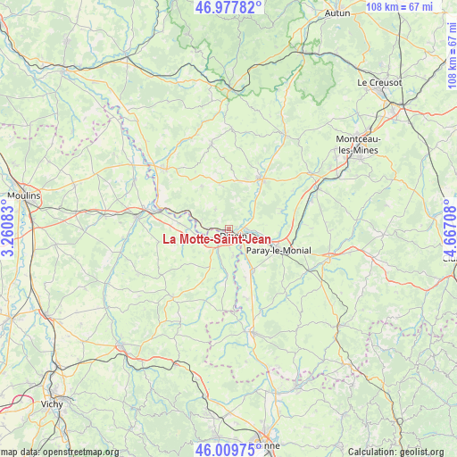
La Motte-Saint-Jean GPS coordinates[2]
46° 29' 45.384" North, 3° 57' 50.256" East
| Map corner | latitude | longitude |
|---|---|---|
| Upper-left | 46.97782°, | 3.26083° |
| Center: | 46.49594°, | 3.96396° |
| Lower-right: | 46.00975°, | 4.66708° |
| Map W x H: | 107.6×107.6 km | = 66.9×66.9mi |
| max Lat: | 51.07786° ⇑60.1% North |
| La Motte-Saint-Jean: | 46.49594° |
| min Lat: | ⇓39.9% South 41.3874° |
| min Long | La Motte-Saint- | max Long |
| -5.08615° | 3.96396° | 9.52242° |
| W 67.4%⇐ | ⇒32.6% E |
Elevation
Elevation of La Motte-Saint-Jean is 299 m = 981 ft, and this is 105.3 m = 345 ft above average elevation for this country.
| Max E: |
2333 m = 7654 ft | 19.2% |
| La Motte-Saint-Jean | 299 m 981 ft | |
| Avg. | 193.7 m = 635 ft | |
Min E: |
-1 m = -3 ft | 80.8% |
See also: France elevation on elevation.city.
Geographical zone
La Motte-Saint-Jean is located in North temperate zone (between Tropic of Cancer and the Arctic Circle). Distance of this North polar circle is 2231.3 km =1386.5 mi to North.| Distance of | km | miles | from La Motte-Saint-Jean |
|---|---|---|---|
| North Pole | 4837.2 | 3005.7 | to North |
| Arctic Circle | 2231.3 | 1386.5 | to North |
| Tropic Cancer | 2563.9 | 1593.1 | to South |
| Equator | 5169.9 | 3212.4 | to South |


Nearby cities:
15 places around La Motte-Saint-Jean: (largest is in red/bold)
• Chalmoux
14.5 km =9 mi,  322°
322°
• Chassenard
6.5 km =4 mi,  169°
169°
• Digoin
2 km =1.2 mi,  144°
144°
• Gilly-sur-Loire
14.9 km =9.3 mi,  288°
288°
• Gueugnon
14.2 km =8.8 mi,  32°
32°
• Molinet
4 km =2.5 mi,  212°
212°
• Neuvy-Grandchamp
10.6 km =6.6 mi,  348°
348°
• Paray-le-Monial
12.5 km =7.8 mi,  111°
111°
• Pierrefitte-sur-Loire
11.4 km =7.1 mi,  275°
275°
• Rigny-sur-Arroux
6.4 km =4 mi,  50°
50°
• Saint-Agnan
7.5 km =4.7 mi,  273°
273°
• Saint-François
10 km =6.2 mi, 206°
• Saint-Yan
11 km =6.8 mi,  148°
148°
• Vendenesse-sur-Arroux
16.6 km =10.3 mi, 27°
• Volesvres
15.2 km =9.4 mi,  100°
100°
Sources, notices
• [Note1] Compared only with cities in France existing in our database
• [Src1] Map data: © OpenStreetMap contributors (CC-BY-SA)
• [Src2] Other city data from geonames.org with taken over terms of usage.
• [Src3] Geographical zone / Annual Mean Temperature by Robert A. Rohde @ Wikipedia
