Chalmoux geodata
Chalmoux (Bourgogne-Franche-Comté) is a populated place; located in France in Europe/Paris (GMT+2) time zone. With population of 780 people, there are 10827 cities with bigger population in this country. Compared to other cities in France, 59.2% of cities are located further ↑North; 66.6% of cities are located further ←West and 81.7% of cities have lower elevation than Chalmoux. Note1
Administrative division(s):
- Level 1: Bourgogne-Franche-Comté
- Level 2: Département de Saône-et-Loire
- Level 3: Arrondissement de Charolles
- Level 4: Chalmoux


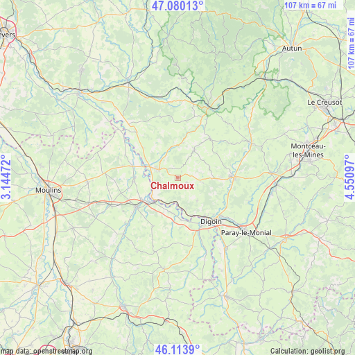
Chalmoux GPS coordinates[2]
46° 35' 57.012" North, 3° 50' 52.26" East
| Map corner | latitude | longitude |
|---|---|---|
| Upper-left | 47.08013°, | 3.14472° |
| Center: | 46.59917°, | 3.84785° |
| Lower-right: | 46.1139°, | 4.55097° |
| Map W x H: | 107.4×107.4 km | = 66.7×66.7mi |
| max Lat: | 51.07786° ⇑59.2% North |
| Chalmoux: | 46.59917° |
| min Lat: | ⇓40.8% South 41.3874° |
| min Long | Chalmoux | max Long |
| -5.08615° | 3.84785° | 9.52242° |
| W 66.6%⇐ | ⇒33.4% E |
Elevation
Elevation of Chalmoux is 308 m = 1010 ft, and this is 114.3 m = 375 ft above average elevation for this country.
| Max E: |
2333 m = 7654 ft | 18.3% |
| Chalmoux | 308 m 1010 ft | |
| Avg. | 193.7 m = 635 ft | |
Min E: |
-1 m = -3 ft | 81.7% |
See also: France elevation on elevation.city.
Geographical zone
Chalmoux is located in North temperate zone (between Tropic of Cancer and the Arctic Circle). Distance of this North polar circle is 2219.8 km =1379.3 mi to North.| Distance of | km | miles | from Chalmoux |
|---|---|---|---|
| North Pole | 4825.7 | 2998.6 | to North |
| Arctic Circle | 2219.8 | 1379.3 | to North |
| Tropic Cancer | 2575.4 | 1600.3 | to South |
| Equator | 5181.3 | 3219.5 | to South |


Nearby cities:
15 places around Chalmoux: (largest is in red/bold)
• Beaulon
13.3 km =8.3 mi,  271°
271°
• Bourbon-Lancy
6.5 km =4 mi,  293°
293°
• Diou
10.7 km =6.6 mi,  227°
227°
• Dompierre-sur-Besbre
15.4 km =9.6 mi,  236°
236°
• Garnat-sur-Engièvre
14.6 km =9.1 mi, 285°
• Gilly-sur-Loire
8.6 km =5.3 mi,  217°
217°
• Grury
9.8 km =6.1 mi,  29°
29°
• Issy-l’Évêque
15.4 km =9.6 mi,  38°
38°
• La Motte-Saint-Jean
14.5 km =9 mi,  142°
142°
• Molinet
16.3 km =10.1 mi,  155°
155°
• Neuvy-Grandchamp
6.8 km =4.2 mi,  99°
99°
• Pierrefitte-sur-Loire
10.6 km =6.6 mi,  193°
193°
• Rigny-sur-Arroux
15.6 km =9.7 mi,  118°
118°
• Saint-Agnan
11.1 km =6.9 mi,  172°
172°
• Uxeau
15.2 km =9.4 mi,  62°
62°
Sources, notices
• [Note1] Compared only with cities in France existing in our database
• [Src1] Map data: © OpenStreetMap contributors (CC-BY-SA)
• [Src2] Other city data from geonames.org with taken over terms of usage.
• [Src3] Geographical zone / Annual Mean Temperature by Robert A. Rohde @ Wikipedia
