Gilly-sur-Loire geodata
Gilly-sur-Loire (Bourgogne-Franche-Comté) is a populated place; located in France in Europe/Paris (GMT+2) time zone. With population of 540 people, there are 14387 cities with bigger population in this country. Compared to other cities in France, 59.8% of cities are located further ↑North; 66.2% of cities are located further ←West and 71.6% of cities have lower elevation than Gilly-sur-Loire. Note1
Administrative division(s):
- Level 1: Bourgogne-Franche-Comté
- Level 2: Département de Saône-et-Loire
- Level 3: Arrondissement de Charolles
- Level 4: Gilly-sur-Loire


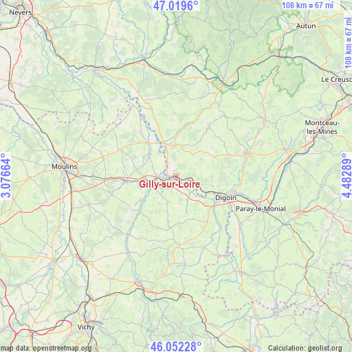
Gilly-sur-Loire GPS coordinates[2]
46° 32' 17.124" North, 3° 46' 47.136" East
| Map corner | latitude | longitude |
|---|---|---|
| Upper-left | 47.0196°, | 3.07664° |
| Center: | 46.53809°, | 3.77976° |
| Lower-right: | 46.05228°, | 4.48289° |
| Map W x H: | 107.6×107.6 km | = 66.9×66.9mi |
| max Lat: | 51.07786° ⇑59.8% North |
| Gilly-sur-Loire: | 46.53809° |
| min Lat: | ⇓40.2% South 41.3874° |
| min Long | Gilly-sur-Loire | max Long |
| -5.08615° | 3.77976° | 9.52242° |
| W 66.2%⇐ | ⇒33.8% E |
Elevation
Elevation of Gilly-sur-Loire is 227 m = 745 ft, and this is 33.3 m = 109 ft above average elevation for this country.
| Max E: |
2333 m = 7654 ft | 28.4% |
| Gilly-sur-Loire | 227 m 745 ft | |
| Avg. | 193.7 m = 635 ft | |
Min E: |
-1 m = -3 ft | 71.6% |
See also: France elevation on elevation.city.
Geographical zone
Gilly-sur-Loire is located in North temperate zone (between Tropic of Cancer and the Arctic Circle). Distance of this North polar circle is 2226.6 km =1383.5 mi to North.| Distance of | km | miles | from Gilly-sur-Loire |
|---|---|---|---|
| North Pole | 4832.5 | 3002.8 | to North |
| Arctic Circle | 2226.6 | 1383.5 | to North |
| Tropic Cancer | 2568.6 | 1596.1 | to South |
| Equator | 5174.6 | 3215.3 | to South |


Nearby cities:
15 places around Gilly-sur-Loire: (largest is in red/bold)
• Beaulon
10.8 km =6.7 mi,  310°
310°
• Bourbon-Lancy
9.4 km =5.8 mi,  355°
355°
• Chalmoux
8.6 km =5.3 mi,  37°
37°
• Digoin
16.5 km =10.3 mi,  112°
112°
• Diou
2.7 km =1.7 mi,  261°
261°
• Dompierre-sur-Besbre
7.8 km =4.8 mi, 256°
• Garnat-sur-Engièvre
13.9 km =8.6 mi,  319°
319°
• La Motte-Saint-Jean
14.9 km =9.3 mi, 108°
• Molinet
14.4 km =8.9 mi,  123°
123°
• Neuvy-Grandchamp
13.2 km =8.2 mi,  64°
64°
• Pierrefitte-sur-Loire
4.5 km =2.8 mi,  141°
141°
• Saint-Agnan
7.9 km =4.9 mi, 122°
• Saligny-sur-Roudon
8.1 km =5 mi,  196°
196°
• Thiel-sur-Acolin
15.2 km =9.4 mi, 263°
• Vaumas
15.4 km =9.6 mi,  228°
228°
Sources, notices
• [Note1] Compared only with cities in France existing in our database
• [Src1] Map data: © OpenStreetMap contributors (CC-BY-SA)
• [Src2] Other city data from geonames.org with taken over terms of usage.
• [Src3] Geographical zone / Annual Mean Temperature by Robert A. Rohde @ Wikipedia
