La Gripperie-Saint-Symphorien geodata
La Gripperie-Saint-Symphorien (Nouvelle-Aquitaine) is a populated place; located in France in Europe/Paris (GMT+2) time zone. With population of 513 people, there are 14965 cities with bigger population in this country. Compared to other cities in France, 69.3% of cities are located further ↑North; 87.6% of cities are located further →East and 89.9% of cities have higher elevation than La Gripperie-Saint-Symphorien. Note1
Administrative division(s):
- Level 1: Nouvelle-Aquitaine
- Level 2: Charente-Maritime
- Level 3: Arrondissement de Rochefort
- Level 4: La Gripperie-Saint-Symphorien
Current local time in La Gripperie-Saint-Symphorien:
09:59 AM, SaturdayDifference from your time zone: hours


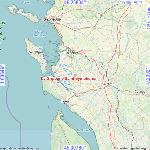
La Gripperie-Saint-Symphorien GPS coordinates[2]
45° 48' 0" North, 0° 55' 59.988" West
| Map corner | latitude | longitude |
|---|---|---|
| Upper-left | 46.28804°, | -1.63646° |
| Center: | 45.8°, | -0.93333° |
| Lower-right: | 45.30765°, | -0.23021° |
| Map W x H: | 109×109 km | = 67.7×67.7mi |
| max Lat: | 51.07786° ⇑69.3% North |
| La Gripperie-Saint-Symphorien: | 45.8° |
| min Lat: | ⇓30.7% South 41.3874° |
| min Long | La Gripperie-Sa | max Long |
| -5.08615° | -0.93333° | 9.52242° |
| W 12.4%⇐ | ⇒87.6% E |
Elevation
Elevation of La Gripperie-Saint-Symphorien is 30 m = 98 ft, and this is 163.7 m = 537 ft below average elevation for this country.
| Max E: |
2333 m = 7654 ft | 89.9% |
| Avg. | 193.7 m = 635 ft | |
| La Gripperie-Saint-Symphorien | 30 m = 98 ft | |
Min E: |
-1 m = -3 ft | 10.1% |
See also: France elevation on elevation.city.
Geographical zone
La Gripperie-Saint-Symphorien is located in North temperate zone (between Tropic of Cancer and the Arctic Circle). Distance of this North polar circle is 2308.7 km =1434.6 mi to North.| Distance of | km | miles | from La Gripperie-Saint-Symphorien |
|---|---|---|---|
| North Pole | 4914.6 | 3053.8 | to North |
| Arctic Circle | 2308.7 | 1434.6 | to North |
| Tropic Cancer | 2486.6 | 1545.1 | to South |
| Equator | 5092.5 | 3164.3 | to South |


Nearby cities:
15 places around La Gripperie-Saint-Symphorien: (largest is in red/bold)
• Beurlay
10.1 km =6.3 mi,  48°
48°
• Champagne
4 km =2.5 mi,  28°
28°
• Corme-Royal
11.1 km =6.9 mi,  124°
124°
• Hiers-Brouage
12.1 km =7.5 mi,  296°
296°
• Le Gua
8.3 km =5.2 mi,  186°
186°
• Nieulle-sur-Seudre
7.6 km =4.7 mi,  223°
223°
• Pont-l’Abbé-d’Arnoult
5.5 km =3.4 mi, 54°
• Sablonceaux
10.6 km =6.6 mi,  160°
160°
• Saint-Agnant
8.5 km =5.3 mi,  345°
345°
• Saint-Just-Luzac
7.8 km =4.8 mi,  270°
270°
• Saint-Porchaire
11.9 km =7.4 mi,  78°
78°
• Sainte-Gemme
4.7 km =2.9 mi,  132°
132°
• Soulignonne
11.6 km =7.2 mi,  102°
102°
• Trizay
9.6 km =6 mi,  17°
17°
• Échillais
11.3 km =7 mi, 352°
Sources, notices
• [Note1] Compared only with cities in France existing in our database
• [Src1] Map data: © OpenStreetMap contributors (CC-BY-SA)
• [Src2] Other city data from geonames.org with taken over terms of usage.
• [Src3] Geographical zone / Annual Mean Temperature by Robert A. Rohde @ Wikipedia
