La Ferté-Imbault geodata
La Ferté-Imbault (Centre) is a populated place; located in France in Europe/Paris (GMT+2) time zone. With population of 1,072 people, there are 8316 cities with bigger population in this country. Compared to other cities in France, 50.3% of cities are located further ↑North; 57.7% of cities are located further →East and 61.2% of cities have higher elevation than La Ferté-Imbault. Note1
Administrative division(s):
- Level 1: Centre
- Level 2: Département du Loir-et-Cher
- Level 3: Arrondissement de Romorantin-Lanthenay
- Level 4: La Ferté-Imbault


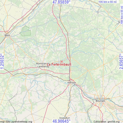
La Ferté-Imbault GPS coordinates[2]
47° 23' 4.812" North, 1° 57' 12.384" East
| Map corner | latitude | longitude |
|---|---|---|
| Upper-left | 47.85859°, | 1.25032° |
| Center: | 47.38467°, | 1.95344° |
| Lower-right: | 46.90645°, | 2.65657° |
| Map W x H: | 105.9×105.9 km | = 65.8×65.8mi |
| max Lat: | 51.07786° ⇑50.3% North |
| La Ferté-Imbault: | 47.38467° |
| min Lat: | ⇓49.7% South 41.3874° |
| min Long | La Ferté-Imbau | max Long |
| -5.08615° | 1.95344° | 9.52242° |
| W 42.3%⇐ | ⇒57.7% E |
Elevation
Elevation of La Ferté-Imbault is 99 m = 325 ft, and this is 94.7 m = 311 ft below average elevation for this country.
| Max E: |
2333 m = 7654 ft | 61.2% |
| Avg. | 193.7 m = 635 ft | |
| La Ferté-Imbault | 99 m = 325 ft | |
Min E: |
-1 m = -3 ft | 38.8% |
See also: France elevation on elevation.city.
Geographical zone
La Ferté-Imbault is located in North temperate zone (between Tropic of Cancer and the Arctic Circle). Distance of this North polar circle is 2132.5 km =1325.1 mi to North.| Distance of | km | miles | from La Ferté-Imbault |
|---|---|---|---|
| North Pole | 4738.4 | 2944.3 | to North |
| Arctic Circle | 2132.5 | 1325.1 | to North |
| Tropic Cancer | 2662.8 | 1654.6 | to South |
| Equator | 5268.7 | 3273.8 | to South |


Nearby cities:
15 places around La Ferté-Imbault: (largest is in red/bold)
• Châtres-sur-Cher
13.8 km =8.6 mi,  195°
195°
• Langon
14.7 km =9.1 mi,  220°
220°
• Marcilly-en-Gault
10.8 km =6.7 mi,  326°
326°
• Mennetou-sur-Cher
14.5 km =9 mi,  207°
207°
• Millançay
15.3 km =9.5 mi,  296°
296°
• Méry-sur-Cher
15.6 km =9.7 mi,  170°
170°
• Romorantin-Lanthenay
15.4 km =9.6 mi,  262°
262°
• Saint-Georges-sur-la-Prée
17.7 km =11 mi,  184°
184°
• Saint-Viâtre
15.6 km =9.7 mi,  354°
354°
• Salbris
8.6 km =5.3 mi,  59°
59°
• Selles-Saint-Denis
2.3 km =1.4 mi,  276°
276°
• Theillay
10.2 km =6.3 mi,  140°
140°
• Thénioux
14.4 km =8.9 mi,  185°
185°
• Villefranche-sur-Cher
16.9 km =10.5 mi,  236°
236°
• Villeherviers
11.7 km =7.3 mi, 260°
Sources, notices
• [Note1] Compared only with cities in France existing in our database
• [Src1] Map data: © OpenStreetMap contributors (CC-BY-SA)
• [Src2] Other city data from geonames.org with taken over terms of usage.
• [Src3] Geographical zone / Annual Mean Temperature by Robert A. Rohde @ Wikipedia
