Romorantin-Lanthenay geodata
Romorantin-Lanthenay (Centre) is a seat of a third-order administrative division; located in France in Europe/Paris (GMT+2) time zone. With population of 19,953 people, there are 456 cities with bigger population in this country. Compared to other cities in France, 50.5% of cities are located further ↑North; 60% of cities are located further →East and 62.8% of cities have higher elevation than Romorantin-Lanthenay. Note1
Administrative division(s):
- Level 1: Centre
- Level 2: Département du Loir-et-Cher
- Level 3: Arrondissement de Romorantin-Lanthenay
- Level 4: Romorantin-Lanthenay


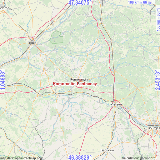
Romorantin-Lanthenay GPS coordinates[2]
47° 22' 0.012" North, 1° 45' 0" East
| Map corner | latitude | longitude |
|---|---|---|
| Upper-left | 47.84075°, | 1.04688° |
| Center: | 47.36667°, | 1.75° |
| Lower-right: | 46.88829°, | 2.45313° |
| Map W x H: | 105.9×105.9 km | = 65.8×65.8mi |
| max Lat: | 51.07786° ⇑50.5% North |
| Romorantin-Lanthenay: | 47.36667° |
| min Lat: | ⇓49.5% South 41.3874° |
| min Long | Romorantin-Lant | max Long |
| -5.08615° | 1.75° | 9.52242° |
| W 40%⇐ | ⇒60% E |
Elevation
Elevation of Romorantin-Lanthenay is 95 m = 312 ft, and this is 98.7 m = 324 ft below average elevation for this country.
| Max E: |
2333 m = 7654 ft | 62.8% |
| Avg. | 193.7 m = 635 ft | |
| Romorantin-Lanthenay | 95 m = 312 ft | |
Min E: |
-1 m = -3 ft | 37.2% |
See also: France elevation on elevation.city.
Geographical zone
Romorantin-Lanthenay is located in North temperate zone (between Tropic of Cancer and the Arctic Circle). Distance of this North polar circle is 2134.5 km =1326.3 mi to North.| Distance of | km | miles | from Romorantin-Lanthenay |
|---|---|---|---|
| North Pole | 4740.4 | 2945.5 | to North |
| Arctic Circle | 2134.5 | 1326.3 | to North |
| Tropic Cancer | 2660.8 | 1653.3 | to South |
| Equator | 5266.7 | 3272.6 | to South |


Nearby cities:
15 places around Romorantin-Lanthenay: (largest is in red/bold)
• Chabris
14.6 km =9.1 mi,  210°
210°
• Gièvres
11.5 km =7.1 mi, 211°
• Gy-en-Sologne
12.9 km =8 mi,  258°
258°
• La Ferté-Imbault
15.4 km =9.6 mi,  82°
82°
• Langon
10.8 km =6.7 mi,  148°
148°
• Marcilly-en-Gault
14.5 km =9 mi,  40°
40°
• Mennetou-sur-Cher
13.8 km =8.6 mi,  141°
141°
• Millançay
9.1 km =5.7 mi,  10°
10°
• Mur-de-Sologne
11.8 km =7.3 mi,  295°
295°
• Pruniers-en-Sologne
8.4 km =5.2 mi,  228°
228°
• Saint-Julien-sur-Cher
9.6 km =6 mi,  169°
169°
• Selles-Saint-Denis
13.2 km =8.2 mi, 80°
• Vernou-en-Sologne
15.8 km =9.8 mi,  340°
340°
• Villefranche-sur-Cher
7.5 km =4.7 mi, 170°
• Villeherviers
3.8 km =2.4 mi,  90°
90°
Sources, notices
• [Note1] Compared only with cities in France existing in our database
• [Src1] Map data: © OpenStreetMap contributors (CC-BY-SA)
• [Src2] Other city data from geonames.org with taken over terms of usage.
• [Src3] Geographical zone / Annual Mean Temperature by Robert A. Rohde @ Wikipedia
