La Rouge geodata
La Rouge (Normandy) is a populated place; located in France in Europe/Paris (GMT+2) time zone. With population of 670 people, there are 12215 cities with bigger population in this country. Compared to other cities in France, 64.3% of cities are located further ↓South; 71.3% of cities are located further →East and 58.7% of cities have higher elevation than La Rouge. Note1
Administrative division(s):
- Level 1: Normandy
- Level 2: Département de l'Orne
- Level 3: Arrondissement de Mortagne-au-Perche
- Level 4: Val-au-Perche


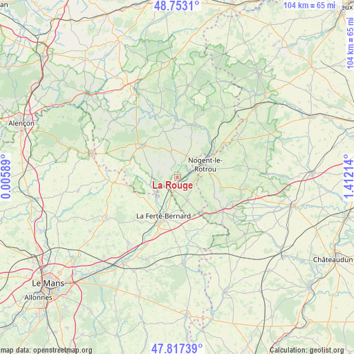
La Rouge GPS coordinates[2]
48° 17' 14.604" North, 0° 42' 32.436" East
| Map corner | latitude | longitude |
|---|---|---|
| Upper-left | 48.7531°, | 0.00589° |
| Center: | 48.28739°, | 0.70901° |
| Lower-right: | 47.81739°, | 1.41214° |
| Map W x H: | 104×104 km | = 64.6×64.6mi |
| max Lat: | 51.07786° ⇑35.7% North |
| La Rouge: | 48.28739° |
| min Lat: | ⇓64.3% South 41.3874° |
| min Long | La Rouge | max Long |
| -5.08615° | 0.70901° | 9.52242° |
| W 28.7%⇐ | ⇒71.3% E |
Elevation
Elevation of La Rouge is 106 m = 348 ft, and this is 87.7 m = 288 ft below average elevation for this country.
| Max E: |
2333 m = 7654 ft | 58.7% |
| Avg. | 193.7 m = 635 ft | |
| La Rouge | 106 m = 348 ft | |
Min E: |
-1 m = -3 ft | 41.3% |
See also: France elevation on elevation.city.
Geographical zone
La Rouge is located in North temperate zone (between Tropic of Cancer and the Arctic Circle). Distance of this North polar circle is 2032.1 km =1262.7 mi to North.| Distance of | km | miles | from La Rouge |
|---|---|---|---|
| North Pole | 4638 | 2881.9 | to North |
| Arctic Circle | 2032.1 | 1262.7 | to North |
| Tropic Cancer | 2763.1 | 1716.9 | to South |
| Equator | 5369.1 | 3336.2 | to South |


Nearby cities:
15 places around La Rouge: (largest is in red/bold)
• Avezé
7.1 km =4.4 mi,  198°
198°
• Ceton
7.4 km =4.6 mi,  156°
156°
• Cherreau
10.7 km =6.6 mi,  190°
190°
• Cormes
13.2 km =8.2 mi,  181°
181°
• La Chapelle-du-Bois
11.3 km =7 mi,  229°
229°
• La Ferté-Bernard
12 km =7.5 mi, 200°
• Margon
10.7 km =6.6 mi,  59°
59°
• Mâle
2.8 km =1.7 mi,  129°
129°
• Nocé
10.4 km =6.5 mi,  348°
348°
• Nogent-le-Rotrou
9.2 km =5.7 mi,  65°
65°
• Préaux-du-Perche
5.1 km =3.2 mi,  6°
6°
• Préval
8.5 km =5.3 mi, 227°
• Saint-Germain-de-la-Coudre
7.7 km =4.8 mi,  264°
264°
• Saint-Hilaire-sur-Erre
3.6 km =2.2 mi,  38°
38°
• Souancé-au-Perche
11.1 km =6.9 mi,  101°
101°
Sources, notices
• [Note1] Compared only with cities in France existing in our database
• [Src1] Map data: © OpenStreetMap contributors (CC-BY-SA)
• [Src2] Other city data from geonames.org with taken over terms of usage.
• [Src3] Geographical zone / Annual Mean Temperature by Robert A. Rohde @ Wikipedia
