Lachapelle-sous-Aubenas geodata
Lachapelle-sous-Aubenas (Auvergne-Rhône-Alpes) is a populated place; located in France in Europe/Paris (GMT+2) time zone. With population of 1,350 people, there are 6810 cities with bigger population in this country. Compared to other cities in France, 83% of cities are located further ↑North; 71.1% of cities are located further ←West and 68.5% of cities have lower elevation than Lachapelle-sous-Aubenas. Note1
Administrative division(s):
- Level 1: Auvergne-Rhône-Alpes
- Level 2: Département de l'Ardèche
- Level 3: Arrondissement de Largentière
- Level 4: Lachapelle-sous-Aubenas
Current local time in Lachapelle-sous-Aubenas:
02:24 PM, SaturdayDifference from your time zone: hours


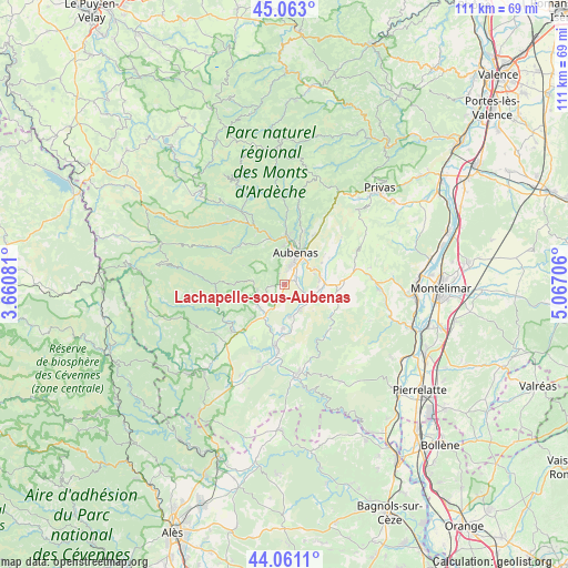
Lachapelle-sous-Aubenas GPS coordinates[2]
44° 33' 51.156" North, 4° 21' 50.148" East
| Map corner | latitude | longitude |
|---|---|---|
| Upper-left | 45.063°, | 3.66081° |
| Center: | 44.56421°, | 4.36393° |
| Lower-right: | 44.0611°, | 5.06706° |
| Map W x H: | 111.4×111.4 km | = 69.2×69.2mi |
| max Lat: | 51.07786° ⇑83% North |
| Lachapelle-sous-Aubenas: | 44.56421° |
| min Lat: | ⇓17% South 41.3874° |
| min Long | Lachapelle-sous | max Long |
| -5.08615° | 4.36393° | 9.52242° |
| W 71.1%⇐ | ⇒28.9% E |
Elevation
Elevation of Lachapelle-sous-Aubenas is 211 m = 692 ft, and this is 17.3 m = 57 ft above average elevation for this country.
| Max E: |
2333 m = 7654 ft | 31.5% |
| Lachapelle-sous-Aubenas | 211 m 692 ft | |
| Avg. | 193.7 m = 635 ft | |
Min E: |
-1 m = -3 ft | 68.5% |
See also: France elevation on elevation.city.
Geographical zone
Lachapelle-sous-Aubenas is located in North temperate zone (between Tropic of Cancer and the Arctic Circle). Distance of this Northern Tropic circle is 2349.2 km =1459.7 mi to South.| Distance of | km | miles | from Lachapelle-sous-Aubenas |
|---|---|---|---|
| North Pole | 5052 | 3139.2 | to North |
| Arctic Circle | 2446.1 | 1519.9 | to North |
| Tropic Cancer | 2349.2 | 1459.7 | to South |
| Equator | 4955.1 | 3079 | to South |


Nearby cities:
15 places around Lachapelle-sous-Aubenas: (largest is in red/bold)
• Aubenas
6.5 km =4 mi,  18°
18°
• Chassiers
5.5 km =3.4 mi,  254°
254°
• Labégude
9 km =5.6 mi,  2°
2°
• Lalevade-d’Ardèche
9.8 km =6.1 mi,  340°
340°
• Largentière
6.1 km =3.8 mi, 246°
• Laurac-en-Vivarais
8.5 km =5.3 mi,  223°
223°
• Lavilledieu
7.2 km =4.5 mi,  79°
79°
• Lussas
10.1 km =6.3 mi,  58°
58°
• Prades
9.1 km =5.7 mi,  334°
334°
• Saint-Didier-sous-Aubenas
6.3 km =3.9 mi,  40°
40°
• Saint-Germain
6.9 km =4.3 mi,  98°
98°
• Saint-Privat
8.2 km =5.1 mi,  29°
29°
• Saint-Sernin
2.4 km =1.5 mi,  69°
69°
• Saint-Étienne-de-Fontbellon
4.4 km =2.7 mi, 23°
• Vogüé
4.3 km =2.7 mi,  110°
110°
Sources, notices
• [Note1] Compared only with cities in France existing in our database
• [Src1] Map data: © OpenStreetMap contributors (CC-BY-SA)
• [Src2] Other city data from geonames.org with taken over terms of usage.
• [Src3] Geographical zone / Annual Mean Temperature by Robert A. Rohde @ Wikipedia
