Chassiers geodata
Chassiers (Auvergne-Rhône-Alpes) is a populated place; located in France in Europe/Paris (GMT+2) time zone. With population of 998 people, there are 8844 cities with bigger population in this country. Compared to other cities in France, 83.2% of cities are located further ↑North; 70.6% of cities are located further ←West and 81.2% of cities have lower elevation than Chassiers. Note1
Administrative division(s):
- Level 1: Auvergne-Rhône-Alpes
- Level 2: Département de l'Ardèche
- Level 3: Arrondissement de Largentière
- Level 4: Chassiers


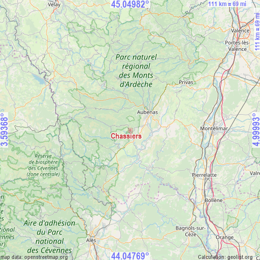
Chassiers GPS coordinates[2]
44° 33' 3.276" North, 4° 17' 48.516" East
| Map corner | latitude | longitude |
|---|---|---|
| Upper-left | 45.04982°, | 3.59368° |
| Center: | 44.55091°, | 4.29681° |
| Lower-right: | 44.04769°, | 4.99993° |
| Map W x H: | 111.4×111.4 km | = 69.2×69.2mi |
| max Lat: | 51.07786° ⇑83.2% North |
| Chassiers: | 44.55091° |
| min Lat: | ⇓16.8% South 41.3874° |
| min Long | Chassiers | max Long |
| -5.08615° | 4.29681° | 9.52242° |
| W 70.6%⇐ | ⇒29.4% E |
Elevation
Elevation of Chassiers is 302 m = 991 ft, and this is 108.3 m = 355 ft above average elevation for this country.
| Max E: |
2333 m = 7654 ft | 18.8% |
| Chassiers | 302 m 991 ft | |
| Avg. | 193.7 m = 635 ft | |
Min E: |
-1 m = -3 ft | 81.2% |
See also: France elevation on elevation.city.
Geographical zone
Chassiers is located in North temperate zone (between Tropic of Cancer and the Arctic Circle). Distance of this Northern Tropic circle is 2347.7 km =1458.8 mi to South.| Distance of | km | miles | from Chassiers |
|---|---|---|---|
| North Pole | 5053.5 | 3140.1 | to North |
| Arctic Circle | 2447.6 | 1520.9 | to North |
| Tropic Cancer | 2347.7 | 1458.8 | to South |
| Equator | 4953.6 | 3078 | to South |


Nearby cities:
15 places around Chassiers: (largest is in red/bold)
• Aubenas
10.7 km =6.6 mi,  44°
44°
• Jaujac
10.1 km =6.3 mi,  341°
341°
• Joyeuse
9.2 km =5.7 mi,  210°
210°
• Lablachère
11.7 km =7.3 mi, 213°
• Lachapelle-sous-Aubenas
5.5 km =3.4 mi,  74°
74°
• Lalevade-d’Ardèche
11 km =6.8 mi,  10°
10°
• Largentière
0.9 km =0.6 mi,  196°
196°
• Laurac-en-Vivarais
4.7 km =2.9 mi,  186°
186°
• Prades
9.8 km =6.1 mi, 8°
• Rosières
8.1 km =5 mi, 202°
• Ruoms
11.5 km =7.1 mi,  161°
161°
• Saint-Didier-sous-Aubenas
11.3 km =7 mi,  56°
56°
• Saint-Sernin
7.9 km =4.9 mi, 73°
• Saint-Étienne-de-Fontbellon
9 km =5.6 mi,  51°
51°
• Vogüé
9.3 km =5.8 mi,  90°
90°
Sources, notices
• [Note1] Compared only with cities in France existing in our database
• [Src1] Map data: © OpenStreetMap contributors (CC-BY-SA)
• [Src2] Other city data from geonames.org with taken over terms of usage.
• [Src3] Geographical zone / Annual Mean Temperature by Robert A. Rohde @ Wikipedia
