La Chapelle-Bouexic geodata
La Chapelle-Bouexic (Brittany) is a populated place; located in France in Europe/Paris (GMT+2) time zone. With population of 877 people, there are 9840 cities with bigger population in this country. Compared to other cities in France, 58% of cities are located further ↓South; 94.6% of cities are located further →East and 75% of cities have higher elevation than La Chapelle-Bouexic. Note1
Administrative division(s):
- Level 1: Brittany
- Level 2: Département d'Ille-et-Vilaine
- Level 3: Arrondissement de Redon
- Level 4: La Chapelle-Bouëxic


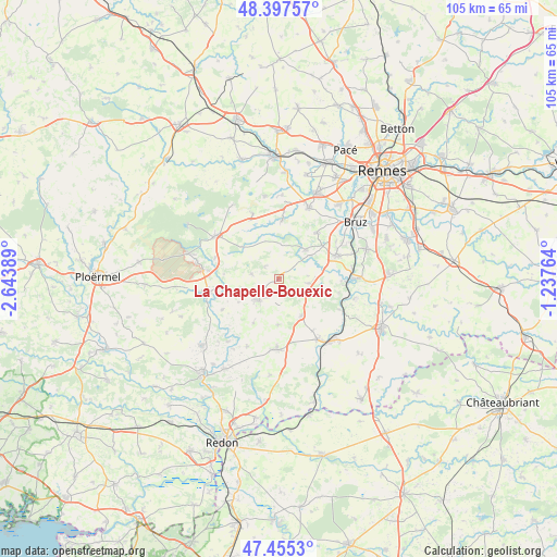
La Chapelle-Bouexic GPS coordinates[2]
47° 55' 42.888" North, 1° 56' 26.736" West
| Map corner | latitude | longitude |
|---|---|---|
| Upper-left | 48.39757°, | -2.64389° |
| Center: | 47.92858°, | -1.94076° |
| Lower-right: | 47.4553°, | -1.23764° |
| Map W x H: | 104.8×104.8 km | = 65.1×65.1mi |
| max Lat: | 51.07786° ⇑42% North |
| La Chapelle-Bouexic: | 47.92858° |
| min Lat: | ⇓58% South 41.3874° |
| min Long | La Chapelle-Bou | max Long |
| -5.08615° | -1.94076° | 9.52242° |
| W 5.4%⇐ | ⇒94.6% E |
Elevation
Elevation of La Chapelle-Bouexic is 67 m = 220 ft, and this is 126.7 m = 416 ft below average elevation for this country.
| Max E: |
2333 m = 7654 ft | 75% |
| Avg. | 193.7 m = 635 ft | |
| La Chapelle-Bouexic | 67 m = 220 ft | |
Min E: |
-1 m = -3 ft | 25% |
See also: France elevation on elevation.city.
Geographical zone
La Chapelle-Bouexic is located in North temperate zone (between Tropic of Cancer and the Arctic Circle). Distance of this North polar circle is 2072 km =1287.5 mi to North.| Distance of | km | miles | from La Chapelle-Bouexic |
|---|---|---|---|
| North Pole | 4677.9 | 2906.7 | to North |
| Arctic Circle | 2072 | 1287.5 | to North |
| Tropic Cancer | 2723.2 | 1692.1 | to South |
| Equator | 5329.2 | 3311.4 | to South |


Nearby cities:
15 places around La Chapelle-Bouexic: (largest is in red/bold)
• Baulon
6.4 km =4 mi,  6°
6°
• Comblessac
12.1 km =7.5 mi,  241°
241°
• Goven
11.1 km =6.9 mi,  39°
39°
• Guichen
11.7 km =7.3 mi,  68°
68°
• Guignen
6 km =3.7 mi,  99°
99°
• Lassy
7.5 km =4.7 mi, 42°
• Lieuron
8.6 km =5.3 mi,  181°
181°
• Lohéac
8.1 km =5 mi,  148°
148°
• Maure-de-Bretagne
5.5 km =3.4 mi,  222°
222°
• Maxent
9.2 km =5.7 mi,  311°
311°
• Mernel
4.1 km =2.5 mi,  211°
211°
• Pipriac
13.2 km =8.2 mi, 181°
• Saint-Malo-de-Phily
12.8 km =8 mi,  116°
116°
• Saint-Senoux
11.7 km =7.3 mi, 102°
• Saint-Thurial
11.2 km =7 mi,  3°
3°
Sources, notices
• [Note1] Compared only with cities in France existing in our database
• [Src1] Map data: © OpenStreetMap contributors (CC-BY-SA)
• [Src2] Other city data from geonames.org with taken over terms of usage.
• [Src3] Geographical zone / Annual Mean Temperature by Robert A. Rohde @ Wikipedia
