Lohéac geodata
Lohéac (Brittany) is a populated place; located in France in Europe/Paris (GMT+2) time zone. With population of 659 people, there are 12396 cities with bigger population in this country. Compared to other cities in France, 56.9% of cities are located further ↓South; 94.4% of cities are located further →East and 85.3% of cities have higher elevation than Lohéac. Note1
Administrative division(s):
- Level 1: Brittany
- Level 2: Département d'Ille-et-Vilaine
- Level 3: Arrondissement de Redon
- Level 4: Lohéac


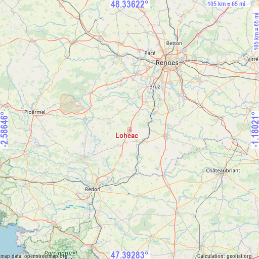
Lohéac GPS coordinates[2]
47° 52' 0.012" North, 1° 52' 59.988" West
| Map corner | latitude | longitude |
|---|---|---|
| Upper-left | 48.33622°, | -2.58646° |
| Center: | 47.86667°, | -1.88333° |
| Lower-right: | 47.39283°, | -1.18021° |
| Map W x H: | 104.9×104.9 km | = 65.2×65.2mi |
| max Lat: | 51.07786° ⇑43.1% North |
| Lohéac: | 47.86667° |
| min Lat: | ⇓56.9% South 41.3874° |
| min Long | Lohéac | max Long |
| -5.08615° | -1.88333° | 9.52242° |
| W 5.6%⇐ | ⇒94.4% E |
Elevation
Elevation of Lohéac is 41 m = 135 ft, and this is 152.7 m = 501 ft below average elevation for this country.
| Max E: |
2333 m = 7654 ft | 85.3% |
| Avg. | 193.7 m = 635 ft | |
| Lohéac | 41 m = 135 ft | |
Min E: |
-1 m = -3 ft | 14.7% |
See also: France elevation on elevation.city.
Geographical zone
Lohéac is located in North temperate zone (between Tropic of Cancer and the Arctic Circle). Distance of this North polar circle is 2078.9 km =1291.8 mi to North.| Distance of | km | miles | from Lohéac |
|---|---|---|---|
| North Pole | 4684.8 | 2911 | to North |
| Arctic Circle | 2078.9 | 1291.8 | to North |
| Tropic Cancer | 2716.4 | 1687.9 | to South |
| Equator | 5322.3 | 3307.1 | to South |


Nearby cities:
15 places around Lohéac: (largest is in red/bold)
• Bourg-des-Comptes
12.4 km =7.7 mi,  55°
55°
• Bruc-sur-Aff
11.7 km =7.3 mi,  240°
240°
• Guignen
6.2 km =3.9 mi,  15°
15°
• Guipry
5.4 km =3.4 mi,  145°
145°
• La Chapelle-Bouexic
8.1 km =5 mi,  328°
328°
• Lassy
12.4 km =7.7 mi,  3°
3°
• Lieuron
4.7 km =2.9 mi,  249°
249°
• Maure-de-Bretagne
8.5 km =5.3 mi,  289°
289°
• Mernel
7.2 km =4.5 mi,  297°
297°
• Messac
7.2 km =4.5 mi,  131°
131°
• Pipriac
7.9 km =4.9 mi,  216°
216°
• Pléchâtel
10.5 km =6.5 mi,  72°
72°
• Saint-Just
12.6 km =7.8 mi,  207°
207°
• Saint-Malo-de-Phily
7.2 km =4.5 mi,  80°
80°
• Saint-Senoux
8.3 km =5.2 mi, 58°
Sources, notices
• [Note1] Compared only with cities in France existing in our database
• [Src1] Map data: © OpenStreetMap contributors (CC-BY-SA)
• [Src2] Other city data from geonames.org with taken over terms of usage.
• [Src3] Geographical zone / Annual Mean Temperature by Robert A. Rohde @ Wikipedia
