Lacanau geodata
Lacanau (Nouvelle-Aquitaine) is a populated place; located in France in Europe/Paris (GMT+2) time zone. With population of 3,410 people, there are 2854 cities with bigger population in this country. Compared to other cities in France, 79.8% of cities are located further ↑North; 88.9% of cities are located further →East and 94.7% of cities have higher elevation than Lacanau. Note1
Administrative division(s):
- Level 1: Nouvelle-Aquitaine
- Level 2: Gironde
- Level 3: Arrondissement de Lesparre-Médoc
- Level 4: Lacanau


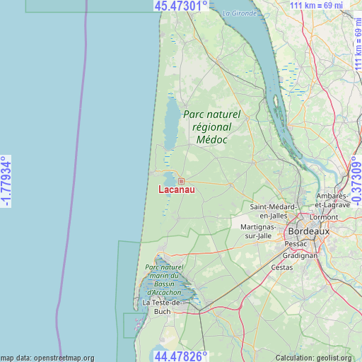
Lacanau GPS coordinates[2]
44° 58' 40.044" North, 1° 4' 34.356" West
| Map corner | latitude | longitude |
|---|---|---|
| Upper-left | 45.47301°, | -1.77934° |
| Center: | 44.97779°, | -1.07621° |
| Lower-right: | 44.47826°, | -0.37309° |
| Map W x H: | 110.6×110.6 km | = 68.7×68.7mi |
| max Lat: | 51.07786° ⇑79.8% North |
| Lacanau: | 44.97779° |
| min Lat: | ⇓20.2% South 41.3874° |
| min Long | Lacanau | max Long |
| -5.08615° | -1.07621° | 9.52242° |
| W 11.1%⇐ | ⇒88.9% E |
Elevation
Elevation of Lacanau is 18 m = 59 ft, and this is 175.7 m = 576 ft below average elevation for this country.
| Max E: |
2333 m = 7654 ft | 94.7% |
| Avg. | 193.7 m = 635 ft | |
| Lacanau | 18 m = 59 ft | |
Min E: |
-1 m = -3 ft | 5.3% |
See also: France elevation on elevation.city.
Geographical zone
Lacanau is located in North temperate zone (between Tropic of Cancer and the Arctic Circle). Distance of this Northern Tropic circle is 2395.1 km =1488.2 mi to South.| Distance of | km | miles | from Lacanau |
|---|---|---|---|
| North Pole | 5006 | 3110.6 | to North |
| Arctic Circle | 2400.1 | 1491.4 | to North |
| Tropic Cancer | 2395.1 | 1488.2 | to South |
| Equator | 5001.1 | 3107.5 | to South |


Nearby cities:
15 places around Lacanau: (largest is in red/bold)
• Andernos-les-Bains
25.9 km =16.1 mi,  184°
184°
• Arès
23.9 km =14.9 mi,  190°
190°
• Avensan
26 km =16.2 mi,  75°
75°
• Carcans
11.5 km =7.1 mi,  12°
12°
• Castelnau-de-Médoc
22.6 km =14 mi, 75°
• Hourtin
23.2 km =14.4 mi,  3°
3°
• Le Porge
11.7 km =7.3 mi, 184°
• Le Temple
12.9 km =8 mi,  147°
147°
• Listrac-Médoc
24.8 km =15.4 mi,  64°
64°
• Martignas-sur-Jalle
27.5 km =17.1 mi,  122°
122°
• Moulis-en-Médoc
25.7 km =16 mi,  69°
69°
• Saint-Aubin-de-Médoc
28.6 km =17.8 mi,  104°
104°
• Saint-Médard-en-Jalles
29.3 km =18.2 mi,  107°
107°
• Sainte-Hélène
15.2 km =9.4 mi,  94°
94°
• Salaunes
19.8 km =12.3 mi, 103°
Sources, notices
• [Note1] Compared only with cities in France existing in our database
• [Src1] Map data: © OpenStreetMap contributors (CC-BY-SA)
• [Src2] Other city data from geonames.org with taken over terms of usage.
• [Src3] Geographical zone / Annual Mean Temperature by Robert A. Rohde @ Wikipedia
