Andernos-les-Bains geodata
Andernos-les-Bains (Nouvelle-Aquitaine) is a populated place; located in France in Europe/Paris (GMT+2) time zone. With population of 10,236 people, there are 923 cities with bigger population in this country. Compared to other cities in France, 81.8% of cities are located further ↑North; 89.1% of cities are located further →East and 99.6% of cities have higher elevation than Andernos-les-Bains. Note1
Administrative division(s):
- Level 1: Nouvelle-Aquitaine
- Level 2: Gironde
- Level 3: Arrondissement d'Arcachon
- Level 4: Andernos-les-Bains


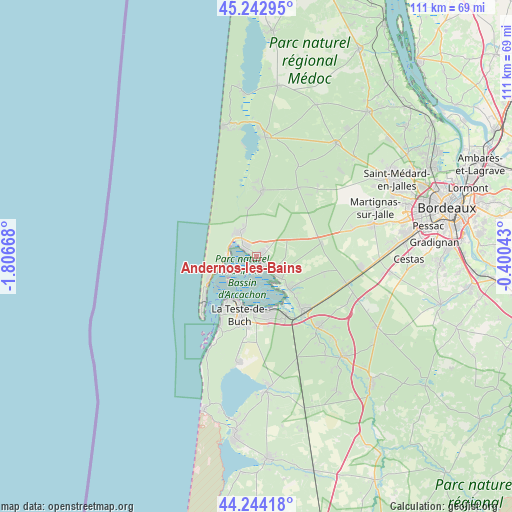
Andernos-les-Bains GPS coordinates[2]
44° 44' 44.592" North, 1° 6' 12.78" West
| Map corner | latitude | longitude |
|---|---|---|
| Upper-left | 45.24295°, | -1.80668° |
| Center: | 44.74572°, | -1.10355° |
| Lower-right: | 44.24418°, | -0.40043° |
| Map W x H: | 111.1×111.1 km | = 69×69mi |
| max Lat: | 51.07786° ⇑81.8% North |
| Andernos-les-Bains: | 44.74572° |
| min Lat: | ⇓18.2% South 41.3874° |
| min Long | Andernos-les-Ba | max Long |
| -5.08615° | -1.10355° | 9.52242° |
| W 10.9%⇐ | ⇒89.1% E |
Elevation
Elevation of Andernos-les-Bains is 4 m = 13 ft, and this is 189.7 m = 622 ft below average elevation for this country.
| Max E: |
2333 m = 7654 ft | 99.6% |
| Avg. | 193.7 m = 635 ft | |
| Andernos-les-Bains | 4 m = 13 ft | |
Min E: |
-1 m = -3 ft | 0.4% |
See also: France elevation on elevation.city.
Geographical zone
Andernos-les-Bains is located in North temperate zone (between Tropic of Cancer and the Arctic Circle). Distance of this Northern Tropic circle is 2369.3 km =1472.2 mi to South.| Distance of | km | miles | from Andernos-les-Bains |
|---|---|---|---|
| North Pole | 5031.8 | 3126.6 | to North |
| Arctic Circle | 2425.9 | 1507.4 | to North |
| Tropic Cancer | 2369.3 | 1472.2 | to South |
| Equator | 4975.3 | 3091.5 | to South |


Nearby cities:
15 places around Andernos-les-Bains: (largest is in red/bold)
• Arcachon
11 km =6.8 mi,  208°
208°
• Arès
3.3 km =2.1 mi,  314°
314°
• Audenge
9.7 km =6 mi,  132°
132°
• Biganos
15.2 km =9.4 mi,  137°
137°
• Gujan-Mestras
12.8 km =8 mi,  166°
166°
• La Teste-de-Buch
13.3 km =8.3 mi,  192°
192°
• Lacanau
25.9 km =16.1 mi,  4°
4°
• Lanton
7 km =4.3 mi, 130°
• Le Porge
14.2 km =8.8 mi, 4°
• Le Teich
14.2 km =8.8 mi,  152°
152°
• Le Temple
17.4 km =10.8 mi,  31°
31°
• Marcheprime
20.5 km =12.7 mi,  107°
107°
• Martignas-sur-Jalle
27.8 km =17.3 mi,  66°
66°
• Mios
20.7 km =12.9 mi, 139°
• Saint-Jean-d’Illac
26 km =16.2 mi, 74°
Sources, notices
• [Note1] Compared only with cities in France existing in our database
• [Src1] Map data: © OpenStreetMap contributors (CC-BY-SA)
• [Src2] Other city data from geonames.org with taken over terms of usage.
• [Src3] Geographical zone / Annual Mean Temperature by Robert A. Rohde @ Wikipedia
