Jossigny geodata
Jossigny (Île-de-France) is a populated place; located in France in Europe/Paris (GMT+2) time zone. With population of 580 people, there are 13652 cities with bigger population in this country. Compared to other cities in France, 76.3% of cities are located further ↓South; 54.3% of cities are located further ←West and 50.2% of cities have higher elevation than Jossigny. Note1
Administrative division(s):
- Level 1: Île-de-France
- Level 2: Seine-et-Marne
- Level 3: Arrondissement de Torcy
- Level 4: Jossigny


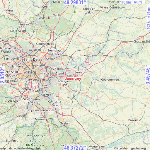
Jossigny GPS coordinates[2]
48° 50' 15.54" North, 2° 45' 15.552" East
| Map corner | latitude | longitude |
|---|---|---|
| Upper-left | 49.29831°, | 2.0512° |
| Center: | 48.83765°, | 2.75432° |
| Lower-right: | 48.37272°, | 3.45745° |
| Map W x H: | 102.9×102.9 km | = 63.9×63.9mi |
| max Lat: | 51.07786° ⇑23.7% North |
| Jossigny: | 48.83765° |
| min Lat: | ⇓76.3% South 41.3874° |
| min Long | Jossigny | max Long |
| -5.08615° | 2.75432° | 9.52242° |
| W 54.3%⇐ | ⇒45.7% E |
Elevation
Elevation of Jossigny is 131 m = 430 ft, and this is 62.7 m = 206 ft below average elevation for this country.
| Max E: |
2333 m = 7654 ft | 50.2% |
| Avg. | 193.7 m = 635 ft | |
| Jossigny | 131 m = 430 ft | |
Min E: |
-1 m = -3 ft | 49.8% |
See also: France elevation on elevation.city.
Geographical zone
Jossigny is located in North temperate zone (between Tropic of Cancer and the Arctic Circle). Distance of this North polar circle is 1970.9 km =1224.7 mi to North.| Distance of | km | miles | from Jossigny |
|---|---|---|---|
| North Pole | 4576.8 | 2843.9 | to North |
| Arctic Circle | 1970.9 | 1224.7 | to North |
| Tropic Cancer | 2824.3 | 1754.9 | to South |
| Equator | 5430.2 | 3374.2 | to South |


Nearby cities:
15 places around Jossigny: (largest is in red/bold)
• Bailly-Romainvilliers
5.2 km =3.2 mi,  78°
78°
• Bussy-Saint-Georges
3.9 km =2.4 mi,  275°
275°
• Bussy-Saint-Martin
4.8 km =3 mi,  285°
285°
• Chanteloup-en-Brie
2.2 km =1.4 mi,  329°
329°
• Chessy
5.2 km =3.2 mi,  10°
10°
• Conches-sur-Gondoire
3.4 km =2.1 mi,  307°
307°
• Ferrières-en-Brie
3.8 km =2.4 mi,  245°
245°
• Gouvernes
5.3 km =3.3 mi,  298°
298°
• Guermantes
4 km =2.5 mi, 295°
• Lagny-sur-Marne
4.2 km =2.6 mi,  319°
319°
• Magny-le-Hongre
5.3 km =3.3 mi,  57°
57°
• Montévrain
4.1 km =2.5 mi,  356°
356°
• Pontcarré
5.7 km =3.5 mi,  219°
219°
• Serris
2.5 km =1.6 mi,  69°
69°
• Villeneuve-Saint-Denis
3.8 km =2.4 mi,  130°
130°
Sources, notices
• [Note1] Compared only with cities in France existing in our database
• [Src1] Map data: © OpenStreetMap contributors (CC-BY-SA)
• [Src2] Other city data from geonames.org with taken over terms of usage.
• [Src3] Geographical zone / Annual Mean Temperature by Robert A. Rohde @ Wikipedia
