Conches-sur-Gondoire geodata
Conches-sur-Gondoire (Île-de-France) is a populated place; located in France in Europe/Paris (GMT+2) time zone. With population of 1,886 people, there are 5057 cities with bigger population in this country. Compared to other cities in France, 76.7% of cities are located further ↓South; 53.7% of cities are located further ←West and 60.8% of cities have higher elevation than Conches-sur-Gondoire. Note1
Administrative division(s):
- Level 1: Île-de-France
- Level 2: Seine-et-Marne
- Level 3: Arrondissement de Torcy
- Level 4: Conches-sur-Gondoire


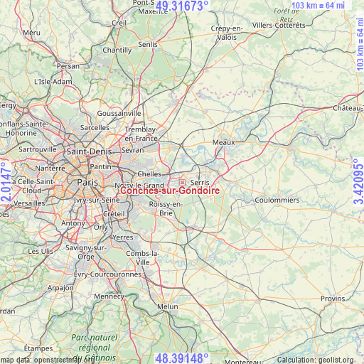
Conches-sur-Gondoire GPS coordinates[2]
48° 51' 22.464" North, 2° 43' 4.188" East
| Map corner | latitude | longitude |
|---|---|---|
| Upper-left | 49.31673°, | 2.0147° |
| Center: | 48.85624°, | 2.71783° |
| Lower-right: | 48.39148°, | 3.42095° |
| Map W x H: | 102.9×102.9 km | = 63.9×63.9mi |
| max Lat: | 51.07786° ⇑23.3% North |
| Conches-sur-Gondoire: | 48.85624° |
| min Lat: | ⇓76.7% South 41.3874° |
| min Long | Conches-sur-Gon | max Long |
| -5.08615° | 2.71783° | 9.52242° |
| W 53.7%⇐ | ⇒46.3% E |
Elevation
Elevation of Conches-sur-Gondoire is 100 m = 328 ft, and this is 93.7 m = 307 ft below average elevation for this country.
| Max E: |
2333 m = 7654 ft | 60.8% |
| Avg. | 193.7 m = 635 ft | |
| Conches-sur-Gondoire | 100 m = 328 ft | |
Min E: |
-1 m = -3 ft | 39.2% |
See also: France elevation on elevation.city.
Geographical zone
Conches-sur-Gondoire is located in North temperate zone (between Tropic of Cancer and the Arctic Circle). Distance of this North polar circle is 1968.9 km =1223.4 mi to North.| Distance of | km | miles | from Conches-sur-Gondoire |
|---|---|---|---|
| North Pole | 4574.8 | 2842.6 | to North |
| Arctic Circle | 1968.9 | 1223.4 | to North |
| Tropic Cancer | 2826.4 | 1756.2 | to South |
| Equator | 5432.3 | 3375.5 | to South |


Nearby cities:
15 places around Conches-sur-Gondoire: (largest is in red/bold)
• Bussy-Saint-Georges
2.1 km =1.3 mi,  214°
214°
• Bussy-Saint-Martin
2.2 km =1.4 mi,  248°
248°
• Chanteloup-en-Brie
1.6 km =1 mi,  95°
95°
• Chessy
4.7 km =2.9 mi,  49°
49°
• Collégien
4 km =2.5 mi,  234°
234°
• Dampmart
4 km =2.5 mi,  25°
25°
• Ferrières-en-Brie
3.7 km =2.3 mi,  192°
192°
• Gouvernes
2 km =1.2 mi,  282°
282°
• Guermantes
1 km =0.6 mi, 249°
• Jossigny
3.4 km =2.1 mi,  127°
127°
• Lagny-sur-Marne
1.2 km =0.7 mi,  355°
355°
• Montévrain
3.1 km =1.9 mi, 50°
• Pomponne
3.8 km =2.4 mi,  317°
317°
• Saint-Thibault-des-Vignes
3.2 km =2 mi,  301°
301°
• Thorigny-sur-Marne
3.4 km =2.1 mi,  0°
0°
Sources, notices
• [Note1] Compared only with cities in France existing in our database
• [Src1] Map data: © OpenStreetMap contributors (CC-BY-SA)
• [Src2] Other city data from geonames.org with taken over terms of usage.
• [Src3] Geographical zone / Annual Mean Temperature by Robert A. Rohde @ Wikipedia
