Gouvernes geodata
Gouvernes (Île-de-France) is a populated place; located in France in Europe/Paris (GMT+2) time zone. With population of 1,132 people, there are 7932 cities with bigger population in this country. Compared to other cities in France, 76.8% of cities are located further ↓South; 53.3% of cities are located further ←West and 80.6% of cities have higher elevation than Gouvernes. Note1
Administrative division(s):
- Level 1: Île-de-France
- Level 2: Seine-et-Marne
- Level 3: Arrondissement de Torcy
- Level 4: Gouvernes


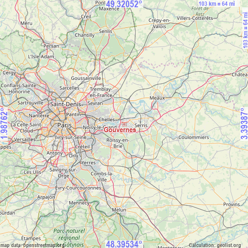
Gouvernes GPS coordinates[2]
48° 51' 36.252" North, 2° 41' 26.664" East
| Map corner | latitude | longitude |
|---|---|---|
| Upper-left | 49.32052°, | 1.98762° |
| Center: | 48.86007°, | 2.69074° |
| Lower-right: | 48.39534°, | 3.39387° |
| Map W x H: | 102.9×102.9 km | = 63.9×63.9mi |
| max Lat: | 51.07786° ⇑23.2% North |
| Gouvernes: | 48.86007° |
| min Lat: | ⇓76.8% South 41.3874° |
| min Long | Gouvernes | max Long |
| -5.08615° | 2.69074° | 9.52242° |
| W 53.3%⇐ | ⇒46.7% E |
Elevation
Elevation of Gouvernes is 53 m = 174 ft, and this is 140.7 m = 462 ft below average elevation for this country.
| Max E: |
2333 m = 7654 ft | 80.6% |
| Avg. | 193.7 m = 635 ft | |
| Gouvernes | 53 m = 174 ft | |
Min E: |
-1 m = -3 ft | 19.4% |
See also: France elevation on elevation.city.
Geographical zone
Gouvernes is located in North temperate zone (between Tropic of Cancer and the Arctic Circle). Distance of this North polar circle is 1968.4 km =1223.1 mi to North.| Distance of | km | miles | from Gouvernes |
|---|---|---|---|
| North Pole | 4574.3 | 2842.3 | to North |
| Arctic Circle | 1968.4 | 1223.1 | to North |
| Tropic Cancer | 2826.8 | 1756.5 | to South |
| Equator | 5432.7 | 3375.7 | to South |


Nearby cities:
15 places around Gouvernes: (largest is in red/bold)
• Bussy-Saint-Georges
2.3 km =1.4 mi,  159°
159°
• Bussy-Saint-Martin
1.2 km =0.7 mi,  181°
181°
• Chanteloup-en-Brie
3.6 km =2.2 mi,  99°
99°
• Collégien
3 km =1.9 mi,  204°
204°
• Conches-sur-Gondoire
2 km =1.2 mi, 102°
• Croissy-Beaubourg
3.9 km =2.4 mi, 203°
• Ferrières-en-Brie
4.2 km =2.6 mi, 164°
• Guermantes
1.3 km =0.8 mi,  126°
126°
• Lagny-sur-Marne
2 km =1.2 mi,  68°
68°
• Montévrain
4.7 km =2.9 mi, 70°
• Pomponne
2.4 km =1.5 mi,  345°
345°
• Saint-Thibault-des-Vignes
1.4 km =0.9 mi,  328°
328°
• Thorigny-sur-Marne
3.6 km =2.2 mi,  33°
33°
• Torcy
3.1 km =1.9 mi,  250°
250°
• Vaires-sur-Marne
4.1 km =2.5 mi,  296°
296°
Sources, notices
• [Note1] Compared only with cities in France existing in our database
• [Src1] Map data: © OpenStreetMap contributors (CC-BY-SA)
• [Src2] Other city data from geonames.org with taken over terms of usage.
• [Src3] Geographical zone / Annual Mean Temperature by Robert A. Rohde @ Wikipedia
