Jarville-la-Malgrange geodata
Jarville-la-Malgrange (Grand Est) is a populated place; located in France in Europe/Paris (GMT+2) time zone. With population of 10,248 people, there are 922 cities with bigger population in this country. Compared to other cities in France, 72.4% of cities are located further ↓South; 89.3% of cities are located further ←West and 66.2% of cities have lower elevation than Jarville-la-Malgrange. Note1
Administrative division(s):
- Level 1: Grand Est
- Level 2: Meurthe-et-Moselle
- Level 3: Arrondissement de Nancy
- Level 4: Jarville-la-Malgrange
Current local time in Jarville-la-Malgrange:
03:48 AM, SaturdayDifference from your time zone: hours


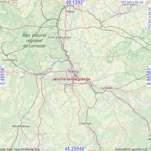
Jarville-la-Malgrange GPS coordinates[2]
48° 40' 1.092" North, 6° 12' 9.684" East
| Map corner | latitude | longitude |
|---|---|---|
| Upper-left | 49.1292°, | 5.49956° |
| Center: | 48.66697°, | 6.20269° |
| Lower-right: | 48.20046°, | 6.90581° |
| Map W x H: | 103.3×103.3 km | = 64.2×64.2mi |
| max Lat: | 51.07786° ⇑27.6% North |
| Jarville-la-Malgrange: | 48.66697° |
| min Lat: | ⇓72.4% South 41.3874° |
| min Long | Jarville-la-Mal | max Long |
| -5.08615° | 6.20269° | 9.52242° |
| W 89.3%⇐ | ⇒10.7% E |
Elevation
Elevation of Jarville-la-Malgrange is 200 m = 656 ft, and this is 6.3 m = 21 ft above average elevation for this country.
| Max E: |
2333 m = 7654 ft | 33.8% |
| Jarville-la-Malgrange | 200 m 656 ft | |
| Avg. | 193.7 m = 635 ft | |
Min E: |
-1 m = -3 ft | 66.2% |
See also: France elevation on elevation.city.
Geographical zone
Jarville-la-Malgrange is located in North temperate zone (between Tropic of Cancer and the Arctic Circle). Distance of this North polar circle is 1989.9 km =1236.5 mi to North.| Distance of | km | miles | from Jarville-la-Malgrange |
|---|---|---|---|
| North Pole | 4595.8 | 2855.7 | to North |
| Arctic Circle | 1989.9 | 1236.5 | to North |
| Tropic Cancer | 2805.3 | 1743.1 | to South |
| Equator | 5411.3 | 3362.4 | to South |


Nearby cities:
15 places around Jarville-la-Malgrange: (largest is in red/bold)
• Art-sur-Meurthe
4.8 km =3 mi,  102°
102°
• Dommartemont
5.2 km =3.2 mi,  9°
9°
• Essey-lès-Nancy
4.6 km =2.9 mi,  22°
22°
• Fléville-devant-Nancy
4.7 km =2.9 mi,  179°
179°
• Heillecourt
1.9 km =1.2 mi,  196°
196°
• Houdemont
3.2 km =2 mi,  217°
217°
• Laneuveville-devant-Nancy
2.1 km =1.3 mi,  123°
123°
• Laxou
4.3 km =2.7 mi,  295°
295°
• Malzéville
5.2 km =3.2 mi,  345°
345°
• Nancy
2.3 km =1.4 mi,  326°
326°
• Saint-Max
4.2 km =2.6 mi,  4°
4°
• Saulxures-lès-Nancy
3.9 km =2.4 mi,  51°
51°
• Tomblaine
2.1 km =1.3 mi,  27°
27°
• Vandœuvre-lès-Nancy
2.4 km =1.5 mi, 217°
• Villers-lès-Nancy
3.7 km =2.3 mi,  280°
280°
Sources, notices
• [Note1] Compared only with cities in France existing in our database
• [Src1] Map data: © OpenStreetMap contributors (CC-BY-SA)
• [Src2] Other city data from geonames.org with taken over terms of usage.
• [Src3] Geographical zone / Annual Mean Temperature by Robert A. Rohde @ Wikipedia
