Isbergues geodata
Isbergues (Hauts-de-France) is a populated place; located in France in Europe/Paris (GMT+2) time zone. With population of 10,067 people, there are 947 cities with bigger population in this country. Compared to other cities in France, 98.3% of cities are located further ↓South; 50.1% of cities are located further →East and 93.9% of cities have higher elevation than Isbergues. Note1
Administrative division(s):
- Level 1: Hauts-de-France
- Level 2: Pas-de-Calais
- Level 3: Arrondissement de Béthune
- Level 4: Isbergues


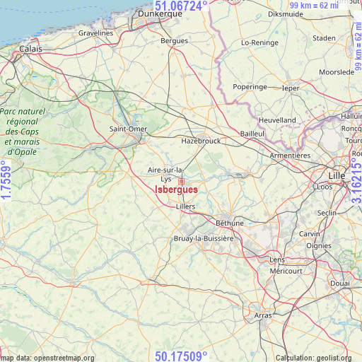
Isbergues GPS coordinates[2]
50° 37' 23.808" North, 2° 27' 32.472" East
| Map corner | latitude | longitude |
|---|---|---|
| Upper-left | 51.06724°, | 1.7559° |
| Center: | 50.62328°, | 2.45902° |
| Lower-right: | 50.17509°, | 3.16215° |
| Map W x H: | 99.2×99.2 km | = 61.6×61.6mi |
| max Lat: | 51.07786° ⇑1.7% North |
| Isbergues: | 50.62328° |
| min Lat: | ⇓98.3% South 41.3874° |
| min Long | Isbergues | max Long |
| -5.08615° | 2.45902° | 9.52242° |
| W 49.9%⇐ | ⇒50.1% E |
Elevation
Elevation of Isbergues is 20 m = 66 ft, and this is 173.7 m = 570 ft below average elevation for this country.
| Max E: |
2333 m = 7654 ft | 93.9% |
| Avg. | 193.7 m = 635 ft | |
| Isbergues | 20 m = 66 ft | |
Min E: |
-1 m = -3 ft | 6.1% |
See also: France elevation on elevation.city.
Geographical zone
Isbergues is located in North temperate zone (between Tropic of Cancer and the Arctic Circle). Distance of this North polar circle is 1772.4 km =1101.3 mi to North.| Distance of | km | miles | from Isbergues |
|---|---|---|---|
| North Pole | 4378.3 | 2720.5 | to North |
| Arctic Circle | 1772.4 | 1101.3 | to North |
| Tropic Cancer | 3022.9 | 1878.3 | to South |
| Equator | 5628.8 | 3497.6 | to South |


Nearby cities:
15 places around Isbergues: (largest is in red/bold)
• Aire-sur-la-Lys
4.6 km =2.9 mi,  291°
291°
• Bourecq
6 km =3.7 mi,  198°
198°
• Busnes
5.7 km =3.5 mi,  133°
133°
• Guarbecque
2.5 km =1.6 mi,  121°
121°
• Ham-en-Artois
3.8 km =2.4 mi,  180°
180°
• Haverskerque
6.1 km =3.8 mi,  71°
71°
• Lambres
4.5 km =2.8 mi,  262°
262°
• Lillers
6.8 km =4.2 mi,  167°
167°
• Norrent-Fontes
6.1 km =3.8 mi,  223°
223°
• Saint-Hilaire-Cottes
6.7 km =4.2 mi,  209°
209°
• Saint-Venant
5.7 km =3.5 mi,  94°
94°
• Steenbecque
5.9 km =3.7 mi,  17°
17°
• Thiennes
3.2 km =2 mi,  9°
9°
• Witternesse
7.1 km =4.4 mi, 257°
• Wittes
7 km =4.3 mi,  317°
317°
Sources, notices
• [Note1] Compared only with cities in France existing in our database
• [Src1] Map data: © OpenStreetMap contributors (CC-BY-SA)
• [Src2] Other city data from geonames.org with taken over terms of usage.
• [Src3] Geographical zone / Annual Mean Temperature by Robert A. Rohde @ Wikipedia
