Imphy geodata
Imphy (Bourgogne-Franche-Comté) is a populated place; located in France in Europe/Paris (GMT+2) time zone. With population of 3,823 people, there are 2578 cities with bigger population in this country. Compared to other cities in France, 55.9% of cities are located further ↑North; 61.5% of cities are located further ←West and 62.4% of cities have lower elevation than Imphy. Note1
Administrative division(s):
- Level 1: Bourgogne-Franche-Comté
- Level 2: Département de la Nièvre
- Level 3: Arrondissement de Nevers
- Level 4: Imphy


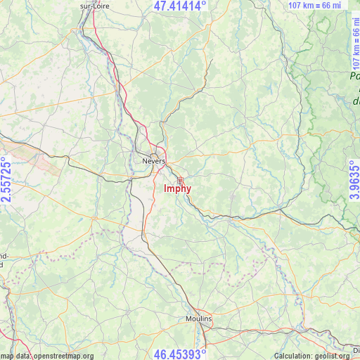
Imphy GPS coordinates[2]
46° 56' 10.284" North, 3° 15' 37.332" East
| Map corner | latitude | longitude |
|---|---|---|
| Upper-left | 47.41414°, | 2.55725° |
| Center: | 46.93619°, | 3.26037° |
| Lower-right: | 46.45393°, | 3.9635° |
| Map W x H: | 106.8×106.8 km | = 66.4×66.4mi |
| max Lat: | 51.07786° ⇑55.9% North |
| Imphy: | 46.93619° |
| min Lat: | ⇓44.1% South 41.3874° |
| min Long | Imphy | max Long |
| -5.08615° | 3.26037° | 9.52242° |
| W 61.5%⇐ | ⇒38.5% E |
Elevation
Elevation of Imphy is 181 m = 594 ft, and this is 12.7 m = 42 ft below average elevation for this country.
| Max E: |
2333 m = 7654 ft | 37.6% |
| Avg. | 193.7 m = 635 ft | |
| Imphy | 181 m = 594 ft | |
Min E: |
-1 m = -3 ft | 62.4% |
See also: France elevation on elevation.city.
Geographical zone
Imphy is located in North temperate zone (between Tropic of Cancer and the Arctic Circle). Distance of this North polar circle is 2182.4 km =1356.1 mi to North.| Distance of | km | miles | from Imphy |
|---|---|---|---|
| North Pole | 4788.2 | 2975.2 | to North |
| Arctic Circle | 2182.4 | 1356.1 | to North |
| Tropic Cancer | 2612.9 | 1623.6 | to South |
| Equator | 5218.8 | 3242.8 | to South |


Nearby cities:
15 places around Imphy: (largest is in red/bold)
• Challuy
8.7 km =5.4 mi,  280°
280°
• Chevenon
3 km =1.9 mi,  232°
232°
• Coulanges-lès-Nevers
9.4 km =5.8 mi,  324°
324°
• Gimouille
13.3 km =8.3 mi,  272°
272°
• La Fermeté
6.5 km =4 mi,  58°
58°
• Luthenay-Uxeloup
9.5 km =5.9 mi,  177°
177°
• Magny-Cours
10.2 km =6.3 mi, 234°
• Montigny-aux-Amognes
10.5 km =6.5 mi,  12°
12°
• Nevers
9.7 km =6 mi,  307°
307°
• Saint-Benin-d’Azy
12.2 km =7.6 mi, 55°
• Saint-Parize-le-Châtel
10.8 km =6.7 mi,  213°
213°
• Saint-Éloi
5 km =3.1 mi,  325°
325°
• Sauvigny-les-Bois
3.5 km =2.2 mi, 14°
• Sermoise-sur-Loire
6 km =3.7 mi, 284°
• Varennes-Vauzelles
12.8 km =8 mi, 314°
Sources, notices
• [Note1] Compared only with cities in France existing in our database
• [Src1] Map data: © OpenStreetMap contributors (CC-BY-SA)
• [Src2] Other city data from geonames.org with taken over terms of usage.
• [Src3] Geographical zone / Annual Mean Temperature by Robert A. Rohde @ Wikipedia
