Coulanges-lès-Nevers geodata
Coulanges-lès-Nevers (Bourgogne-Franche-Comté) is a populated place; located in France in Europe/Paris (GMT+2) time zone. With population of 3,610 people, there are 2707 cities with bigger population in this country. Compared to other cities in France, 55.2% of cities are located further ↑North; 60.4% of cities are located further ←West and 63.6% of cities have lower elevation than Coulanges-lès-Nevers. Note1
Administrative division(s):
- Level 1: Bourgogne-Franche-Comté
- Level 2: Département de la Nièvre
- Level 3: Arrondissement de Nevers
- Level 4: Coulanges-lès-Nevers
Current local time in Coulanges-lès-Nevers:
04:42 AM, WednesdayDifference from your time zone: hours


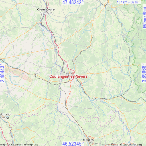
Coulanges-lès-Nevers GPS coordinates[2]
47° 0' 18.324" North, 3° 11' 15.216" East
| Map corner | latitude | longitude |
|---|---|---|
| Upper-left | 47.48242°, | 2.48443° |
| Center: | 47.00509°, | 3.18756° |
| Lower-right: | 46.52345°, | 3.89068° |
| Map W x H: | 106.6×106.6 km | = 66.2×66.2mi |
| max Lat: | 51.07786° ⇑55.2% North |
| Coulanges-lès-Nevers: | 47.00509° |
| min Lat: | ⇓44.8% South 41.3874° |
| min Long | Coulanges-lès- | max Long |
| -5.08615° | 3.18756° | 9.52242° |
| W 60.4%⇐ | ⇒39.6% E |
Elevation
Elevation of Coulanges-lès-Nevers is 187 m = 614 ft, and this is 6.7 m = 22 ft below average elevation for this country.
| Max E: |
2333 m = 7654 ft | 36.4% |
| Avg. | 193.7 m = 635 ft | |
| Coulanges-lès-Nevers | 187 m = 614 ft | |
Min E: |
-1 m = -3 ft | 63.6% |
See also: France elevation on elevation.city.
Geographical zone
Coulanges-lès-Nevers is located in North temperate zone (between Tropic of Cancer and the Arctic Circle). Distance of this North polar circle is 2174.7 km =1351.3 mi to North.| Distance of | km | miles | from Coulanges-lès-Nevers |
|---|---|---|---|
| North Pole | 4780.6 | 2970.5 | to North |
| Arctic Circle | 2174.7 | 1351.3 | to North |
| Tropic Cancer | 2620.6 | 1628.4 | to South |
| Equator | 5226.5 | 3247.6 | to South |


Nearby cities:
15 places around Coulanges-lès-Nevers: (largest is in red/bold)
• Challuy
6.8 km =4.2 mi,  205°
205°
• Chevenon
10 km =6.2 mi,  161°
161°
• Fourchambault
8 km =5 mi,  279°
279°
• Garchizy
8.4 km =5.2 mi,  304°
304°
• Guérigny
9.2 km =5.7 mi,  6°
6°
• Imphy
9.4 km =5.8 mi,  144°
144°
• Marzy
7.6 km =4.7 mi,  249°
249°
• Montigny-aux-Amognes
8.2 km =5.1 mi,  72°
72°
• Nevers
2.8 km =1.7 mi,  231°
231°
• Parigny-les-Vaux
10 km =6.2 mi,  343°
343°
• Saint-Éloi
4.4 km =2.7 mi, 143°
• Sauvigny-les-Bois
7.7 km =4.8 mi,  123°
123°
• Sermoise-sur-Loire
6.1 km =3.8 mi,  182°
182°
• Urzy
5 km =3.1 mi, 13°
• Varennes-Vauzelles
3.8 km =2.4 mi,  289°
289°
Sources, notices
• [Note1] Compared only with cities in France existing in our database
• [Src1] Map data: © OpenStreetMap contributors (CC-BY-SA)
• [Src2] Other city data from geonames.org with taken over terms of usage.
• [Src3] Geographical zone / Annual Mean Temperature by Robert A. Rohde @ Wikipedia
