Saint-Benin-d’Azy geodata
Saint-Benin-d’Azy (Bourgogne-Franche-Comté) is a populated place; located in France in Europe/Paris (GMT+2) time zone. With population of 1,275 people, there are 7150 cities with bigger population in this country. Compared to other cities in France, 55.3% of cities are located further ↑North; 63.1% of cities are located further ←West and 75% of cities have lower elevation than Saint-Benin-d’Azy. Note1
Administrative division(s):
- Level 1: Bourgogne-Franche-Comté
- Level 2: Département de la Nièvre
- Level 3: Arrondissement de Nevers
- Level 4: Saint-Benin-d'Azy


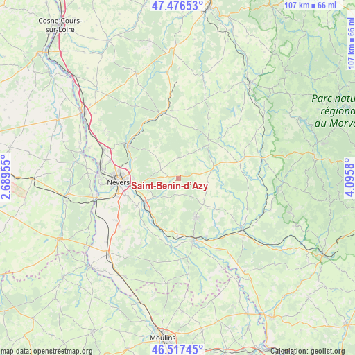
Saint-Benin-d’Azy GPS coordinates[2]
46° 59' 56.904" North, 3° 23' 33.612" East
| Map corner | latitude | longitude |
|---|---|---|
| Upper-left | 47.47653°, | 2.68955° |
| Center: | 46.99914°, | 3.39267° |
| Lower-right: | 46.51745°, | 4.0958° |
| Map W x H: | 106.6×106.6 km | = 66.2×66.2mi |
| max Lat: | 51.07786° ⇑55.3% North |
| Saint-Benin-d’Azy: | 46.99914° |
| min Lat: | ⇓44.7% South 41.3874° |
| min Long | Saint-Benin-d� | max Long |
| -5.08615° | 3.39267° | 9.52242° |
| W 63.1%⇐ | ⇒36.9% E |
Elevation
Elevation of Saint-Benin-d’Azy is 249 m = 817 ft, and this is 55.3 m = 181 ft above average elevation for this country.
| Max E: |
2333 m = 7654 ft | 25% |
| Saint-Benin-d’Azy | 249 m 817 ft | |
| Avg. | 193.7 m = 635 ft | |
Min E: |
-1 m = -3 ft | 75% |
See also: France elevation on elevation.city.
Geographical zone
Saint-Benin-d’Azy is located in North temperate zone (between Tropic of Cancer and the Arctic Circle). Distance of this North polar circle is 2175.4 km =1351.7 mi to North.| Distance of | km | miles | from Saint-Benin-d’Azy |
|---|---|---|---|
| North Pole | 4781.2 | 2970.9 | to North |
| Arctic Circle | 2175.4 | 1351.7 | to North |
| Tropic Cancer | 2619.9 | 1627.9 | to South |
| Equator | 5225.8 | 3247.2 | to South |


Nearby cities:
15 places around Saint-Benin-d’Azy: (largest is in red/bold)
• Chevenon
15.2 km =9.4 mi,  234°
234°
• Coulanges-lès-Nevers
15.6 km =9.7 mi,  272°
272°
• Guérigny
17.5 km =10.9 mi,  304°
304°
• Imphy
12.2 km =7.6 mi,  235°
235°
• La Fermeté
5.8 km =3.6 mi, 231°
• La Machine
13.1 km =8.1 mi,  155°
155°
• Montigny-aux-Amognes
8.4 km =5.2 mi,  292°
292°
• Nevers
17.8 km =11.1 mi, 266°
• Rouy
11.1 km =6.9 mi,  74°
74°
• Saint-Saulge
14.9 km =9.3 mi,  37°
37°
• Saint-Éloi
13.2 km =8.2 mi,  257°
257°
• Sauvigny-les-Bois
9.8 km =6.1 mi,  248°
248°
• Sermoise-sur-Loire
16.8 km =10.4 mi, 251°
• Sougy-sur-Loire
15.9 km =9.9 mi,  180°
180°
• Urzy
15.4 km =9.6 mi, 290°
Sources, notices
• [Note1] Compared only with cities in France existing in our database
• [Src1] Map data: © OpenStreetMap contributors (CC-BY-SA)
• [Src2] Other city data from geonames.org with taken over terms of usage.
• [Src3] Geographical zone / Annual Mean Temperature by Robert A. Rohde @ Wikipedia
