Hermé geodata
Hermé (Île-de-France) is a populated place; located in France in Europe/Paris (GMT+2) time zone. With population of 586 people, there are 13542 cities with bigger population in this country. Compared to other cities in France, 68% of cities are located further ↓South; 62.6% of cities are located further ←West and 77.8% of cities have higher elevation than Hermé. Note1
Administrative division(s):
- Level 1: Île-de-France
- Level 2: Seine-et-Marne
- Level 3: Arrondissement de Provins
- Level 4: Hermé


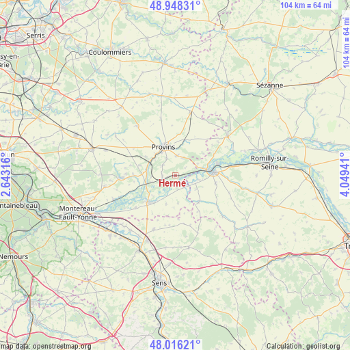
Hermé GPS coordinates[2]
48° 29' 3.84" North, 3° 20' 46.644" East
| Map corner | latitude | longitude |
|---|---|---|
| Upper-left | 48.94831°, | 2.64316° |
| Center: | 48.4844°, | 3.34629° |
| Lower-right: | 48.01621°, | 4.04941° |
| Map W x H: | 103.6×103.6 km | = 64.4×64.4mi |
| max Lat: | 51.07786° ⇑32% North |
| Hermé: | 48.4844° |
| min Lat: | ⇓68% South 41.3874° |
| min Long | Hermé | max Long |
| -5.08615° | 3.34629° | 9.52242° |
| W 62.6%⇐ | ⇒37.4% E |
Elevation
Elevation of Hermé is 60 m = 197 ft, and this is 133.7 m = 439 ft below average elevation for this country.
| Max E: |
2333 m = 7654 ft | 77.8% |
| Avg. | 193.7 m = 635 ft | |
| Hermé | 60 m = 197 ft | |
Min E: |
-1 m = -3 ft | 22.2% |
See also: France elevation on elevation.city.
Geographical zone
Hermé is located in North temperate zone (between Tropic of Cancer and the Arctic Circle). Distance of this North polar circle is 2010.2 km =1249.1 mi to North.| Distance of | km | miles | from Hermé |
|---|---|---|---|
| North Pole | 4616.1 | 2868.3 | to North |
| Arctic Circle | 2010.2 | 1249.1 | to North |
| Tropic Cancer | 2785 | 1730.5 | to South |
| Equator | 5391 | 3349.8 | to South |


Nearby cities:
15 places around Hermé: (largest is in red/bold)
• Chalautre-la-Grande
10.5 km =6.5 mi,  52°
52°
• Chalautre-la-Petite
5.6 km =3.5 mi,  333°
333°
• Chalmaison
7 km =4.3 mi,  268°
268°
• Everly
7.4 km =4.6 mi,  254°
254°
• Fontaine-Fourches
8.5 km =5.3 mi,  157°
157°
• Gouaix
3.9 km =2.4 mi, 271°
• Jutigny
8.6 km =5.3 mi,  280°
280°
• Le Plessis-Mériot
7.6 km =4.7 mi,  63°
63°
• Les Ormes-sur-Voulzie
8.9 km =5.5 mi, 254°
• Longueville
8.1 km =5 mi,  294°
294°
• Provins
9 km =5.6 mi,  337°
337°
• Saint-Brice
9.4 km =5.8 mi,  350°
350°
• Sainte-Colombe
8.4 km =5.2 mi,  307°
307°
• Soisy-Bouy
4.9 km =3 mi, 308°
• Sourdun
5.9 km =3.7 mi,  4°
4°
Sources, notices
• [Note1] Compared only with cities in France existing in our database
• [Src1] Map data: © OpenStreetMap contributors (CC-BY-SA)
• [Src2] Other city data from geonames.org with taken over terms of usage.
• [Src3] Geographical zone / Annual Mean Temperature by Robert A. Rohde @ Wikipedia
