Guyancourt geodata
Guyancourt (Île-de-France) is a populated place; located in France in Europe/Paris (GMT+2) time zone. With population of 31,989 people, there are 246 cities with bigger population in this country. Compared to other cities in France, 74.9% of cities are located further ↓South; 56.1% of cities are located further →East and 58% of cities have lower elevation than Guyancourt. Note1
Administrative division(s):
- Level 1: Île-de-France
- Level 2: Yvelines
- Level 3: Arrondissement de Versailles
- Level 4: Guyancourt


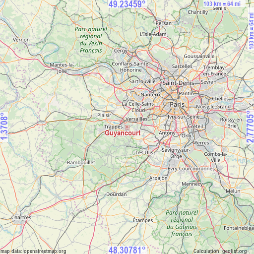
Guyancourt GPS coordinates[2]
48° 46' 24.024" North, 2° 4' 26.148" East
| Map corner | latitude | longitude |
|---|---|---|
| Upper-left | 49.23459°, | 1.3708° |
| Center: | 48.77334°, | 2.07393° |
| Lower-right: | 48.30781°, | 2.77705° |
| Map W x H: | 103×103 km | = 64×64mi |
| max Lat: | 51.07786° ⇑25.1% North |
| Guyancourt: | 48.77334° |
| min Lat: | ⇓74.9% South 41.3874° |
| min Long | Guyancourt | max Long |
| -5.08615° | 2.07393° | 9.52242° |
| W 43.9%⇐ | ⇒56.1% E |
Elevation
Elevation of Guyancourt is 161 m = 528 ft, and this is 32.7 m = 107 ft below average elevation for this country.
| Max E: |
2333 m = 7654 ft | 42% |
| Avg. | 193.7 m = 635 ft | |
| Guyancourt | 161 m = 528 ft | |
Min E: |
-1 m = -3 ft | 58% |
See also: France elevation on elevation.city.
Geographical zone
Guyancourt is located in North temperate zone (between Tropic of Cancer and the Arctic Circle). Distance of this North polar circle is 1978.1 km =1229.1 mi to North.| Distance of | km | miles | from Guyancourt |
|---|---|---|---|
| North Pole | 4584 | 2848.4 | to North |
| Arctic Circle | 1978.1 | 1229.1 | to North |
| Tropic Cancer | 2817.2 | 1750.5 | to South |
| Equator | 5423.1 | 3369.8 | to South |


Nearby cities:
15 places around Guyancourt: (largest is in red/bold)
• Bois-d’Arcy
4.7 km =2.9 mi,  308°
308°
• Buc
3.8 km =2.4 mi,  85°
85°
• Châteaufort
4.3 km =2.7 mi,  163°
163°
• Fontenay-le-Fleury
4.7 km =2.9 mi,  336°
336°
• Le Chesnay
6.5 km =4 mi,  33°
33°
• Les Loges-en-Josas
5 km =3.1 mi,  102°
102°
• Magny-les-Hameaux
3.4 km =2.1 mi,  195°
195°
• Montigny-le-Bretonneux
3 km =1.9 mi,  255°
255°
• Saint-Cyr-l’École
2.8 km =1.7 mi,  351°
351°
• Saint-Quentin-en-Yvelines
4 km =2.5 mi,  267°
267°
• Toussus-le-Noble
3.9 km =2.4 mi,  132°
132°
• Trappes
4.1 km =2.5 mi, 271°
• Versailles
5.6 km =3.5 mi,  52°
52°
• Villiers-le-Bâcle
6 km =3.7 mi,  146°
146°
• Voisins-le-Bretonneux
2.4 km =1.5 mi,  223°
223°
Sources, notices
• [Note1] Compared only with cities in France existing in our database
• [Src1] Map data: © OpenStreetMap contributors (CC-BY-SA)
• [Src2] Other city data from geonames.org with taken over terms of usage.
• [Src3] Geographical zone / Annual Mean Temperature by Robert A. Rohde @ Wikipedia
