Montigny-le-Bretonneux geodata
Montigny-le-Bretonneux (Île-de-France) is a populated place; located in France in Europe/Paris (GMT+2) time zone. With population of 39,063 people, there are 188 cities with bigger population in this country. Compared to other cities in France, 74.7% of cities are located further ↓South; 56.7% of cities are located further →East and 58.3% of cities have lower elevation than Montigny-le-Bretonneux. Note1
Administrative division(s):
- Level 1: Île-de-France
- Level 2: Yvelines
- Level 3: Arrondissement de Versailles
- Level 4: Montigny-le-Bretonneux


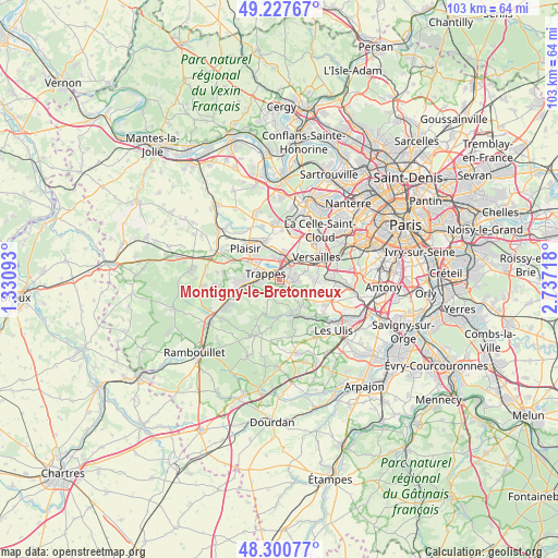
Montigny-le-Bretonneux GPS coordinates[2]
48° 45' 58.896" North, 2° 2' 2.58" East
| Map corner | latitude | longitude |
|---|---|---|
| Upper-left | 49.22767°, | 1.33093° |
| Center: | 48.76636°, | 2.03405° |
| Lower-right: | 48.30077°, | 2.73718° |
| Map W x H: | 103.1×103.1 km | = 64.1×64.1mi |
| max Lat: | 51.07786° ⇑25.3% North |
| Montigny-le-Bretonneux: | 48.76636° |
| min Lat: | ⇓74.7% South 41.3874° |
| min Long | Montigny-le-Bre | max Long |
| -5.08615° | 2.03405° | 9.52242° |
| W 43.3%⇐ | ⇒56.7% E |
Elevation
Elevation of Montigny-le-Bretonneux is 162 m = 531 ft, and this is 31.7 m = 104 ft below average elevation for this country.
| Max E: |
2333 m = 7654 ft | 41.7% |
| Avg. | 193.7 m = 635 ft | |
| Montigny-le-Bretonneux | 162 m = 531 ft | |
Min E: |
-1 m = -3 ft | 58.3% |
See also: France elevation on elevation.city.
Geographical zone
Montigny-le-Bretonneux is located in North temperate zone (between Tropic of Cancer and the Arctic Circle). Distance of this North polar circle is 1978.9 km =1229.6 mi to North.| Distance of | km | miles | from Montigny-le-Bretonneux |
|---|---|---|---|
| North Pole | 4584.8 | 2848.9 | to North |
| Arctic Circle | 1978.9 | 1229.6 | to North |
| Tropic Cancer | 2816.4 | 1750 | to South |
| Equator | 5422.3 | 3369.3 | to South |


Nearby cities:
15 places around Montigny-le-Bretonneux: (largest is in red/bold)
• Bois-d’Arcy
3.8 km =2.4 mi,  347°
347°
• Buc
6.8 km =4.2 mi,  80°
80°
• Chevreuse
6.6 km =4.1 mi,  180°
180°
• Châteaufort
5.4 km =3.4 mi,  129°
129°
• Fontenay-le-Fleury
5.2 km =3.2 mi,  11°
11°
• Guyancourt
3 km =1.9 mi, 75°
• La Verrière
6.6 km =4.1 mi,  256°
256°
• Le Mesnil-Saint-Denis
6.2 km =3.9 mi,  247°
247°
• Magny-les-Hameaux
3.2 km =2 mi,  141°
141°
• Saint-Cyr-l’École
4.4 km =2.7 mi,  34°
34°
• Saint-Quentin-en-Yvelines
1.3 km =0.8 mi,  298°
298°
• Toussus-le-Noble
6.1 km =3.8 mi,  108°
108°
• Trappes
1.5 km =0.9 mi,  305°
305°
• Voisins-le-Bretonneux
1.6 km =1 mi, 126°
• Élancourt
6.1 km =3.8 mi,  288°
288°
Sources, notices
• [Note1] Compared only with cities in France existing in our database
• [Src1] Map data: © OpenStreetMap contributors (CC-BY-SA)
• [Src2] Other city data from geonames.org with taken over terms of usage.
• [Src3] Geographical zone / Annual Mean Temperature by Robert A. Rohde @ Wikipedia
