Brest geodata
Brest (Brittany) is a seat of a third-order administrative division; located in France in Europe/Paris (GMT+2) time zone. With population of 144,899 people, there are 22 cities with bigger population in this country. Compared to other cities in France, 66.1% of cities are located further ↓South; 99.8% of cities are located further →East and 82.2% of cities have higher elevation than Brest. Note1
Administrative division(s):
- Level 1: Brittany
- Level 2: Département du Finistère
- Level 3: Arrondissement de Brest
- Level 4: Brest


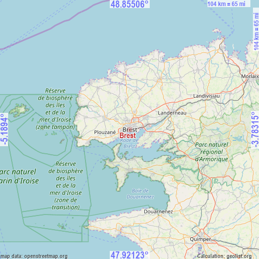
Brest GPS coordinates[2]
48° 23' 25.044" North, 4° 29' 10.608" West
| Map corner | latitude | longitude |
|---|---|---|
| Upper-left | 48.85506°, | -5.1894° |
| Center: | 48.39029°, | -4.48628° |
| Lower-right: | 47.92123°, | -3.78315° |
| Map W x H: | 103.8×103.8 km | = 64.5×64.5mi |
| max Lat: | 51.07786° ⇑33.9% North |
| Brest: | 48.39029° |
| min Lat: | ⇓66.1% South 41.3874° |
| min Long | Brest | max Long |
| -5.08615° | -4.48628° | 9.52242° |
| W 0.2%⇐ | ⇒99.8% E |
Elevation
Elevation of Brest is 49 m = 161 ft, and this is 144.7 m = 475 ft below average elevation for this country.
| Max E: |
2333 m = 7654 ft | 82.2% |
| Avg. | 193.7 m = 635 ft | |
| Brest | 49 m = 161 ft | |
Min E: |
-1 m = -3 ft | 17.8% |
See also: Brest elevation on elevation.city.
Geographical zone
Brest is located in North temperate zone (between Tropic of Cancer and the Arctic Circle). Distance of this North polar circle is 2020.7 km =1255.6 mi to North.| Distance of | km | miles | from Brest |
|---|---|---|---|
| North Pole | 4626.6 | 2874.8 | to North |
| Arctic Circle | 2020.7 | 1255.6 | to North |
| Tropic Cancer | 2774.6 | 1724.1 | to South |
| Equator | 5380.5 | 3343.3 | to South |


Nearby cities:
15 places around Brest: (largest is in red/bold)
• Bohars
4.8 km =3 mi,  335°
335°
• Bourg-Blanc
12.1 km =7.5 mi,  353°
353°
• Gouesnou
7.1 km =4.4 mi,  13°
13°
• Guilers
6.6 km =4.1 mi,  306°
306°
• Guipavas
8.3 km =5.2 mi,  52°
52°
• Guipronvel
12.9 km =8 mi,  330°
330°
• Kersaint-Plabennec
12.4 km =7.7 mi,  42°
42°
• Lanvéoc
11.5 km =7.1 mi,  171°
171°
• Le Relecq-Kerhuon
7.1 km =4.4 mi,  74°
74°
• Milizac
10.4 km =6.5 mi, 325°
• Plougastel-Daoulas
9.2 km =5.7 mi,  106°
106°
• Plouzané
9.7 km =6 mi,  265°
265°
• Rd pt des Chataigniers, Rte de Milizac, Guilers, Finistère, France
7.7 km =4.8 mi, 308°
• Roscanvel
9.6 km =6 mi,  209°
209°
• Saint-Renan
10.7 km =6.6 mi,  296°
296°
Sources, notices
• [Note1] Compared only with cities in France existing in our database
• [Src1] Map data: © OpenStreetMap contributors (CC-BY-SA)
• [Src2] Other city data from geonames.org with taken over terms of usage.
• [Src3] Geographical zone / Annual Mean Temperature by Robert A. Rohde @ Wikipedia
