Grignan geodata
Grignan (Auvergne-Rhône-Alpes) is a populated place; located in France in Europe/Paris (GMT+2) time zone. With population of 1,443 people, there are 6415 cities with bigger population in this country. Compared to other cities in France, 84.1% of cities are located further ↑North; 76.6% of cities are located further ←West and 67% of cities have lower elevation than Grignan. Note1
Administrative division(s):
- Level 1: Auvergne-Rhône-Alpes
- Level 2: Département de la Drôme
- Level 3: Arrondissement de Nyons
- Level 4: Grignan


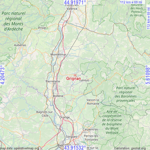
Grignan GPS coordinates[2]
44° 25' 10.812" North, 4° 54' 28.26" East
| Map corner | latitude | longitude |
|---|---|---|
| Upper-left | 44.91971°, | 4.20473° |
| Center: | 44.41967°, | 4.90785° |
| Lower-right: | 43.91532°, | 5.61098° |
| Map W x H: | 111.7×111.7 km | = 69.4×69.4mi |
| max Lat: | 51.07786° ⇑84.1% North |
| Grignan: | 44.41967° |
| min Lat: | ⇓15.9% South 41.3874° |
| min Long | Grignan | max Long |
| -5.08615° | 4.90785° | 9.52242° |
| W 76.6%⇐ | ⇒23.4% E |
Elevation
Elevation of Grignan is 204 m = 669 ft, and this is 10.3 m = 34 ft above average elevation for this country.
| Max E: |
2333 m = 7654 ft | 33% |
| Grignan | 204 m 669 ft | |
| Avg. | 193.7 m = 635 ft | |
Min E: |
-1 m = -3 ft | 67% |
See also: France elevation on elevation.city.
Geographical zone
Grignan is located in North temperate zone (between Tropic of Cancer and the Arctic Circle). Distance of this Northern Tropic circle is 2333.1 km =1449.7 mi to South.| Distance of | km | miles | from Grignan |
|---|---|---|---|
| North Pole | 5068.1 | 3149.2 | to North |
| Arctic Circle | 2462.2 | 1529.9 | to North |
| Tropic Cancer | 2333.1 | 1449.7 | to South |
| Equator | 4939 | 3069 | to South |


Nearby cities:
15 places around Grignan: (largest is in red/bold)
• Allan
12.7 km =7.9 mi,  312°
312°
• Bouchet
13.6 km =8.5 mi,  191°
191°
• Chamaret
3.3 km =2.1 mi,  220°
220°
• Espeluche
12.8 km =8 mi,  327°
327°
• Grillon
3.2 km =2 mi,  147°
147°
• La Baume-de-Transit
9.8 km =6.1 mi,  199°
199°
• La Bégude-de-Mazenc
13.9 km =8.6 mi,  8°
8°
• La Garde-Adhémar
12.2 km =7.6 mi,  258°
258°
• Les Granges-Gontardes
11.4 km =7.1 mi,  268°
268°
• Montségur-sur-Lauzon
7.8 km =4.8 mi,  212°
212°
• Richerenches
6.7 km =4.2 mi,  176°
176°
• Taulignan
5.7 km =3.5 mi,  61°
61°
• Valaurie
7.7 km =4.8 mi, 273°
• Valréas
7.7 km =4.8 mi,  120°
120°
• Visan
12.2 km =7.6 mi,  163°
163°
Sources, notices
• [Note1] Compared only with cities in France existing in our database
• [Src1] Map data: © OpenStreetMap contributors (CC-BY-SA)
• [Src2] Other city data from geonames.org with taken over terms of usage.
• [Src3] Geographical zone / Annual Mean Temperature by Robert A. Rohde @ Wikipedia
