Bouchet geodata
Bouchet (Auvergne-Rhône-Alpes) is a populated place; located in France in Europe/Paris (GMT+2) time zone. With population of 738 people, there are 11315 cities with bigger population in this country. Compared to other cities in France, 84.9% of cities are located further ↑North; 76.1% of cities are located further ←West and 57.3% of cities have higher elevation than Bouchet. Note1
Administrative division(s):
- Level 1: Auvergne-Rhône-Alpes
- Level 2: Département de la Drôme
- Level 3: Arrondissement de Nyons
- Level 4: Bouchet


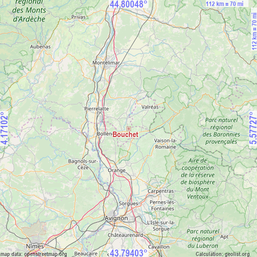
Bouchet GPS coordinates[2]
44° 17' 57.876" North, 4° 52' 26.904" East
| Map corner | latitude | longitude |
|---|---|---|
| Upper-left | 44.80048°, | 4.17102° |
| Center: | 44.29941°, | 4.87414° |
| Lower-right: | 43.79403°, | 5.57727° |
| Map W x H: | 111.9×111.9 km | = 69.5×69.5mi |
| max Lat: | 51.07786° ⇑84.9% North |
| Bouchet: | 44.29941° |
| min Lat: | ⇓15.1% South 41.3874° |
| min Long | Bouchet | max Long |
| -5.08615° | 4.87414° | 9.52242° |
| W 76.1%⇐ | ⇒23.9% E |
Elevation
Elevation of Bouchet is 110 m = 361 ft, and this is 83.7 m = 275 ft below average elevation for this country.
| Max E: |
2333 m = 7654 ft | 57.3% |
| Avg. | 193.7 m = 635 ft | |
| Bouchet | 110 m = 361 ft | |
Min E: |
-1 m = -3 ft | 42.7% |
See also: France elevation on elevation.city.
Geographical zone
Bouchet is located in North temperate zone (between Tropic of Cancer and the Arctic Circle). Distance of this Northern Tropic circle is 2319.7 km =1441.4 mi to South.| Distance of | km | miles | from Bouchet |
|---|---|---|---|
| North Pole | 5081.4 | 3157.4 | to North |
| Arctic Circle | 2475.5 | 1538.2 | to North |
| Tropic Cancer | 2319.7 | 1441.4 | to South |
| Equator | 4925.6 | 3060.6 | to South |


Nearby cities:
15 places around Bouchet: (largest is in red/bold)
• Bollène
10.2 km =6.3 mi,  258°
258°
• Cairanne
8.7 km =5.4 mi,  147°
147°
• Chamaret
10.9 km =6.8 mi,  3°
3°
• La Baume-de-Transit
4.2 km =2.6 mi,  350°
350°
• Montségur-sur-Lauzon
7 km =4.3 mi, 347°
• Richerenches
7.3 km =4.5 mi,  24°
24°
• Rochegude
7.2 km =4.5 mi,  211°
211°
• Saint-Maurice-sur-Eygues
10.9 km =6.8 mi,  89°
89°
• Saint-Paul-Trois-Châteaux
10.2 km =6.3 mi,  300°
300°
• Saint-Restitut
7 km =4.3 mi,  293°
293°
• Sainte-Cécile-les-Vignes
6.1 km =3.8 mi,  170°
170°
• Suze-la-Rousse
2.9 km =1.8 mi,  243°
243°
• Tulette
4.8 km =3 mi,  107°
107°
• Uchaux
10.9 km =6.8 mi, 212°
• Visan
6.3 km =3.9 mi,  74°
74°
Sources, notices
• [Note1] Compared only with cities in France existing in our database
• [Src1] Map data: © OpenStreetMap contributors (CC-BY-SA)
• [Src2] Other city data from geonames.org with taken over terms of usage.
• [Src3] Geographical zone / Annual Mean Temperature by Robert A. Rohde @ Wikipedia
