Greneville-en-Beauce geodata
Greneville-en-Beauce (Centre) is a populated place; located in France in Europe/Paris (GMT+2) time zone. With population of 623 people, there are 12932 cities with bigger population in this country. Compared to other cities in France, 62.5% of cities are located further ↓South; 55.7% of cities are located further →East and 52% of cities have higher elevation than Greneville-en-Beauce. Note1
Administrative division(s):
- Level 1: Centre
- Level 2: Loiret
- Level 3: Arrondissement de Pithiviers
- Level 4: Greneville-en-Beauce


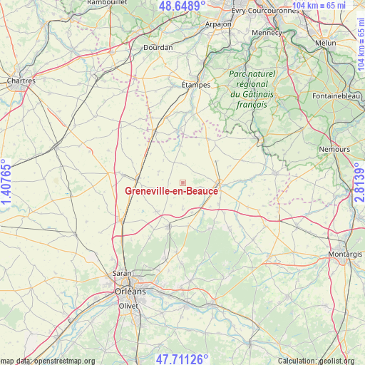
Greneville-en-Beauce GPS coordinates[2]
48° 10' 55.992" North, 2° 6' 38.772" East
| Map corner | latitude | longitude |
|---|---|---|
| Upper-left | 48.6489°, | 1.40765° |
| Center: | 48.18222°, | 2.11077° |
| Lower-right: | 47.71126°, | 2.8139° |
| Map W x H: | 104.3×104.3 km | = 64.8×64.8mi |
| max Lat: | 51.07786° ⇑37.5% North |
| Greneville-en-Beauce: | 48.18222° |
| min Lat: | ⇓62.5% South 41.3874° |
| min Long | Greneville-en-B | max Long |
| -5.08615° | 2.11077° | 9.52242° |
| W 44.3%⇐ | ⇒55.7% E |
Elevation
Elevation of Greneville-en-Beauce is 125 m = 410 ft, and this is 68.7 m = 225 ft below average elevation for this country.
| Max E: |
2333 m = 7654 ft | 52% |
| Avg. | 193.7 m = 635 ft | |
| Greneville-en-Beauce | 125 m = 410 ft | |
Min E: |
-1 m = -3 ft | 48% |
See also: France elevation on elevation.city.
Geographical zone
Greneville-en-Beauce is located in North temperate zone (between Tropic of Cancer and the Arctic Circle). Distance of this North polar circle is 2043.8 km =1270 mi to North.| Distance of | km | miles | from Greneville-en-Beauce |
|---|---|---|---|
| North Pole | 4649.7 | 2889.2 | to North |
| Arctic Circle | 2043.8 | 1270 | to North |
| Tropic Cancer | 2751.4 | 1709.6 | to South |
| Equator | 5357.4 | 3328.9 | to South |


Nearby cities:
15 places around Greneville-en-Beauce: (largest is in red/bold)
• Aschères-le-Marché
11.1 km =6.9 mi,  223°
223°
• Ascoux
12.2 km =7.6 mi,  119°
119°
• Autruy-sur-Juine
10.5 km =6.5 mi,  356°
356°
• Bazoches-les-Gallerandes
5.3 km =3.3 mi,  249°
249°
• Chilleurs-aux-Bois
12.4 km =7.7 mi,  171°
171°
• Dadonville
12.2 km =7.6 mi,  102°
102°
• Escrennes
7.9 km =4.9 mi,  133°
133°
• Mareau-aux-Bois
10.5 km =6.5 mi,  146°
146°
• Neuville-aux-Bois
13.4 km =8.3 mi,  198°
198°
• Outarville
7.5 km =4.7 mi,  298°
298°
• Pithiviers
10.5 km =6.5 mi, 96°
• Pithiviers-le-Vieil
7.6 km =4.7 mi,  106°
106°
• Puiseaux
10.7 km =6.6 mi, 200°
• Sermaises
14.5 km =9 mi,  28°
28°
• Toury
13.1 km =8.1 mi,  275°
275°
Sources, notices
• [Note1] Compared only with cities in France existing in our database
• [Src1] Map data: © OpenStreetMap contributors (CC-BY-SA)
• [Src2] Other city data from geonames.org with taken over terms of usage.
• [Src3] Geographical zone / Annual Mean Temperature by Robert A. Rohde @ Wikipedia
