Bazoches-les-Gallerandes geodata
Bazoches-les-Gallerandes (Centre) is a populated place; located in France in Europe/Paris (GMT+2) time zone. With population of 1,428 people, there are 6494 cities with bigger population in this country. Compared to other cities in France, 62.2% of cities are located further ↓South; 56.5% of cities are located further →East and 50.9% of cities have higher elevation than Bazoches-les-Gallerandes. Note1
Administrative division(s):
- Level 1: Centre
- Level 2: Loiret
- Level 3: Arrondissement de Pithiviers
- Level 4: Bazoches-les-Gallerandes
Current local time in Bazoches-les-Gallerandes:
07:57 AM, SaturdayDifference from your time zone: hours


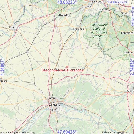
Bazoches-les-Gallerandes GPS coordinates[2]
48° 9' 55.44" North, 2° 2' 35.484" East
| Map corner | latitude | longitude |
|---|---|---|
| Upper-left | 48.63223°, | 1.34007° |
| Center: | 48.1654°, | 2.04319° |
| Lower-right: | 47.69428°, | 2.74632° |
| Map W x H: | 104.3×104.3 km | = 64.8×64.8mi |
| max Lat: | 51.07786° ⇑37.8% North |
| Bazoches-les-Gallerandes: | 48.1654° |
| min Lat: | ⇓62.2% South 41.3874° |
| min Long | Bazoches-les-Ga | max Long |
| -5.08615° | 2.04319° | 9.52242° |
| W 43.5%⇐ | ⇒56.5% E |
Elevation
Elevation of Bazoches-les-Gallerandes is 129 m = 423 ft, and this is 64.7 m = 212 ft below average elevation for this country.
| Max E: |
2333 m = 7654 ft | 50.9% |
| Avg. | 193.7 m = 635 ft | |
| Bazoches-les-Gallerandes | 129 m = 423 ft | |
Min E: |
-1 m = -3 ft | 49.1% |
See also: France elevation on elevation.city.
Geographical zone
Bazoches-les-Gallerandes is located in North temperate zone (between Tropic of Cancer and the Arctic Circle). Distance of this North polar circle is 2045.7 km =1271.1 mi to North.| Distance of | km | miles | from Bazoches-les-Gallerandes |
|---|---|---|---|
| North Pole | 4651.6 | 2890.4 | to North |
| Arctic Circle | 2045.7 | 1271.1 | to North |
| Tropic Cancer | 2749.6 | 1708.5 | to South |
| Equator | 5355.5 | 3327.8 | to South |


Nearby cities:
15 places around Bazoches-les-Gallerandes: (largest is in red/bold)
• Artenay
15.2 km =9.4 mi,  232°
232°
• Aschères-le-Marché
6.7 km =4.2 mi,  203°
203°
• Autruy-sur-Juine
13.1 km =8.1 mi,  19°
19°
• Chilleurs-aux-Bois
12.4 km =7.7 mi,  146°
146°
• Escrennes
11.4 km =7.1 mi,  108°
108°
• Greneville-en-Beauce
5.3 km =3.3 mi,  69°
69°
• Janville
12.8 km =8 mi,  289°
289°
• Mareau-aux-Bois
12.8 km =8 mi,  122°
122°
• Neuville-aux-Bois
10.8 km =6.7 mi,  175°
175°
• Outarville
5.6 km =3.5 mi,  343°
343°
• Pithiviers
15.5 km =9.6 mi,  87°
87°
• Pithiviers-le-Vieil
12.3 km =7.6 mi, 91°
• Puiseaux
8.2 km =5.1 mi,  171°
171°
• Saint-Lyé-la-Forêt
14.6 km =9.1 mi, 197°
• Toury
8.6 km =5.3 mi, 291°
Sources, notices
• [Note1] Compared only with cities in France existing in our database
• [Src1] Map data: © OpenStreetMap contributors (CC-BY-SA)
• [Src2] Other city data from geonames.org with taken over terms of usage.
• [Src3] Geographical zone / Annual Mean Temperature by Robert A. Rohde @ Wikipedia
