Chilleurs-aux-Bois geodata
Chilleurs-aux-Bois (Centre) is a populated place; located in France in Europe/Paris (GMT+2) time zone. With population of 1,810 people, there are 5233 cities with bigger population in this country. Compared to other cities in France, 60.6% of cities are located further ↓South; 55.3% of cities are located further →East and 53.1% of cities have higher elevation than Chilleurs-aux-Bois. Note1
Administrative division(s):
- Level 1: Centre
- Level 2: Loiret
- Level 3: Arrondissement de Pithiviers
- Level 4: Chilleurs-aux-Bois


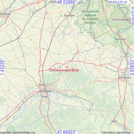
Chilleurs-aux-Bois GPS coordinates[2]
48° 4' 19.92" North, 2° 8' 7.44" East
| Map corner | latitude | longitude |
|---|---|---|
| Upper-left | 48.53988°, | 1.43228° |
| Center: | 48.0722°, | 2.1354° |
| Lower-right: | 47.60023°, | 2.83853° |
| Map W x H: | 104.5×104.5 km | = 64.9×64.9mi |
| max Lat: | 51.07786° ⇑39.4% North |
| Chilleurs-aux-Bois: | 48.0722° |
| min Lat: | ⇓60.6% South 41.3874° |
| min Long | Chilleurs-aux-B | max Long |
| -5.08615° | 2.1354° | 9.52242° |
| W 44.7%⇐ | ⇒55.3% E |
Elevation
Elevation of Chilleurs-aux-Bois is 122 m = 400 ft, and this is 71.7 m = 235 ft below average elevation for this country.
| Max E: |
2333 m = 7654 ft | 53.1% |
| Avg. | 193.7 m = 635 ft | |
| Chilleurs-aux-Bois | 122 m = 400 ft | |
Min E: |
-1 m = -3 ft | 46.9% |
See also: France elevation on elevation.city.
Geographical zone
Chilleurs-aux-Bois is located in North temperate zone (between Tropic of Cancer and the Arctic Circle). Distance of this North polar circle is 2056 km =1277.5 mi to North.| Distance of | km | miles | from Chilleurs-aux-Bois |
|---|---|---|---|
| North Pole | 4661.9 | 2896.8 | to North |
| Arctic Circle | 2056 | 1277.5 | to North |
| Tropic Cancer | 2739.2 | 1702.1 | to South |
| Equator | 5345.1 | 3321.3 | to South |


Nearby cities:
15 places around Chilleurs-aux-Bois: (largest is in red/bold)
• Aschères-le-Marché
10.4 km =6.5 mi,  293°
293°
• Ascoux
10.8 km =6.7 mi,  54°
54°
• Bazoches-les-Gallerandes
12.4 km =7.7 mi,  326°
326°
• Chambon-la-Forêt
12 km =7.5 mi,  98°
98°
• Escrennes
7.8 km =4.8 mi,  30°
30°
• Greneville-en-Beauce
12.4 km =7.7 mi,  351°
351°
• Loury
8.9 km =5.5 mi,  204°
204°
• Mareau-aux-Bois
5.3 km =3.3 mi, 48°
• Neuville-aux-Bois
6.1 km =3.8 mi,  265°
265°
• Pithiviers-le-Vieil
11.5 km =7.1 mi, 28°
• Puiseaux
6.1 km =3.8 mi, 291°
• Rebréchien
11.6 km =7.2 mi,  215°
215°
• Saint-Lyé-la-Forêt
11.9 km =7.4 mi,  252°
252°
• Traînou
11.2 km =7 mi,  192°
192°
• Vrigny
8.6 km =5.3 mi,  84°
84°
Sources, notices
• [Note1] Compared only with cities in France existing in our database
• [Src1] Map data: © OpenStreetMap contributors (CC-BY-SA)
• [Src2] Other city data from geonames.org with taken over terms of usage.
• [Src3] Geographical zone / Annual Mean Temperature by Robert A. Rohde @ Wikipedia
