Autruy-sur-Juine geodata
Autruy-sur-Juine (Centre) is a populated place; located in France in Europe/Paris (GMT+2) time zone. With population of 857 people, there are 10014 cities with bigger population in this country. Compared to other cities in France, 64.1% of cities are located further ↓South; 55.8% of cities are located further →East and 55.6% of cities have higher elevation than Autruy-sur-Juine. Note1
Administrative division(s):
- Level 1: Centre
- Level 2: Loiret
- Level 3: Arrondissement de Pithiviers
- Level 4: Autruy-sur-Juine


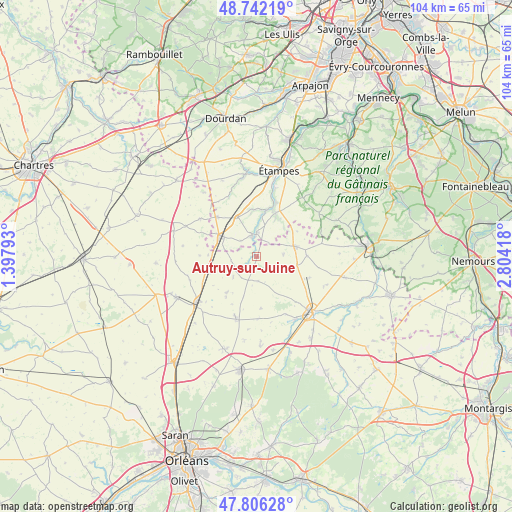
Autruy-sur-Juine GPS coordinates[2]
48° 16' 34.968" North, 2° 6' 3.816" East
| Map corner | latitude | longitude |
|---|---|---|
| Upper-left | 48.74219°, | 1.39793° |
| Center: | 48.27638°, | 2.10106° |
| Lower-right: | 47.80628°, | 2.80418° |
| Map W x H: | 104.1×104.1 km | = 64.7×64.7mi |
| max Lat: | 51.07786° ⇑35.9% North |
| Autruy-sur-Juine: | 48.27638° |
| min Lat: | ⇓64.1% South 41.3874° |
| min Long | Autruy-sur-Juin | max Long |
| -5.08615° | 2.10106° | 9.52242° |
| W 44.2%⇐ | ⇒55.8% E |
Elevation
Elevation of Autruy-sur-Juine is 115 m = 377 ft, and this is 78.7 m = 258 ft below average elevation for this country.
| Max E: |
2333 m = 7654 ft | 55.6% |
| Avg. | 193.7 m = 635 ft | |
| Autruy-sur-Juine | 115 m = 377 ft | |
Min E: |
-1 m = -3 ft | 44.4% |
See also: France elevation on elevation.city.
Geographical zone
Autruy-sur-Juine is located in North temperate zone (between Tropic of Cancer and the Arctic Circle). Distance of this North polar circle is 2033.3 km =1263.4 mi to North.| Distance of | km | miles | from Autruy-sur-Juine |
|---|---|---|---|
| North Pole | 4639.2 | 2882.7 | to North |
| Arctic Circle | 2033.3 | 1263.4 | to North |
| Tropic Cancer | 2761.9 | 1716.2 | to South |
| Equator | 5367.8 | 3335.4 | to South |


Nearby cities:
15 places around Autruy-sur-Juine: (largest is in red/bold)
• Angerville
8.6 km =5.3 mi,  298°
298°
• Bazoches-les-Gallerandes
13.1 km =8.1 mi,  199°
199°
• Chalo-Saint-Mars
16.6 km =10.3 mi,  350°
350°
• Escrennes
17.2 km =10.7 mi,  157°
157°
• Greneville-en-Beauce
10.5 km =6.5 mi,  176°
176°
• Guillerval
9.8 km =6.1 mi,  359°
359°
• Méréville
4.4 km =2.7 mi, 345°
• Ormoy-la-Rivière
14.7 km =9.1 mi,  14°
14°
• Outarville
9.1 km =5.7 mi,  220°
220°
• Pithiviers
16.1 km =10 mi,  136°
136°
• Pithiviers-le-Vieil
14.9 km =9.3 mi,  147°
147°
• Pussay
11.4 km =7.1 mi,  315°
315°
• Saclas
9.3 km =5.8 mi, 10°
• Sermaises
8 km =5 mi,  73°
73°
• Toury
15.3 km =9.5 mi,  233°
233°
Sources, notices
• [Note1] Compared only with cities in France existing in our database
• [Src1] Map data: © OpenStreetMap contributors (CC-BY-SA)
• [Src2] Other city data from geonames.org with taken over terms of usage.
• [Src3] Geographical zone / Annual Mean Temperature by Robert A. Rohde @ Wikipedia
