Gouzon geodata
Gouzon (Nouvelle-Aquitaine) is a populated place; located in France in Europe/Paris (GMT+2) time zone. With population of 1,410 people, there are 6565 cities with bigger population in this country. Compared to other cities in France, 63.7% of cities are located further ↑North; 53.7% of cities are located further →East and 86.9% of cities have lower elevation than Gouzon. Note1
Administrative division(s):
- Level 1: Nouvelle-Aquitaine
- Level 2: Creuse
- Level 3: Aubusson
- Level 4: Gouzon


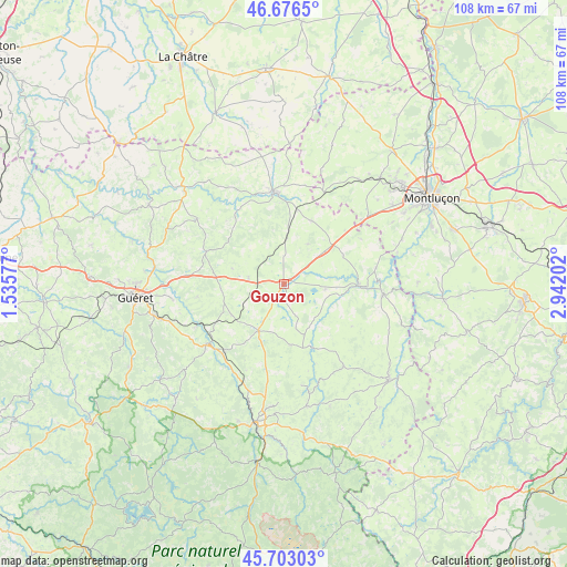
Gouzon GPS coordinates[2]
46° 11' 30.912" North, 2° 14' 20.004" East
| Map corner | latitude | longitude |
|---|---|---|
| Upper-left | 46.6765°, | 1.53577° |
| Center: | 46.19192°, | 2.23889° |
| Lower-right: | 45.70303°, | 2.94202° |
| Map W x H: | 108.2×108.2 km | = 67.2×67.2mi |
| max Lat: | 51.07786° ⇑63.7% North |
| Gouzon: | 46.19192° |
| min Lat: | ⇓36.3% South 41.3874° |
| min Long | Gouzon | max Long |
| -5.08615° | 2.23889° | 9.52242° |
| W 46.3%⇐ | ⇒53.7% E |
Elevation
Elevation of Gouzon is 371 m = 1217 ft, and this is 177.3 m = 582 ft above average elevation for this country.
| Max E: |
2333 m = 7654 ft | 13.1% |
| Gouzon | 371 m 1217 ft | |
| Avg. | 193.7 m = 635 ft | |
Min E: |
-1 m = -3 ft | 86.9% |
See also: France elevation on elevation.city.
Geographical zone
Gouzon is located in North temperate zone (between Tropic of Cancer and the Arctic Circle). Distance of this North polar circle is 2265.1 km =1407.5 mi to North.| Distance of | km | miles | from Gouzon |
|---|---|---|---|
| North Pole | 4871 | 3026.7 | to North |
| Arctic Circle | 2265.1 | 1407.5 | to North |
| Tropic Cancer | 2530.1 | 1572.1 | to South |
| Equator | 5136.1 | 3191.4 | to South |


Nearby cities:
15 places around Gouzon: (largest is in red/bold)
• Ajain
18.7 km =11.6 mi,  275°
275°
• Boussac
17.5 km =10.9 mi,  355°
355°
• Budelière
17.9 km =11.1 mi,  79°
79°
• Chambon-sur-Voueize
14.3 km =8.9 mi,  90°
90°
• Chénérailles
10.1 km =6.3 mi,  209°
209°
• Clugnat
16.1 km =10 mi,  324°
324°
• Cressat
11.6 km =7.2 mi,  240°
240°
• Jarnages
12 km =7.5 mi,  264°
264°
• Lavaveix-les-Mines
17.7 km =11 mi,  220°
220°
• Parsac
6.8 km =4.2 mi, 279°
• Pionnat
16.6 km =10.3 mi, 261°
• Saint-Médard-la-Rochette
17.2 km =10.7 mi,  203°
203°
• Saint-Silvain-Bas-le-Roc
15.5 km =9.6 mi, 357°
• Soumans
13.2 km =8.2 mi,  23°
23°
• Vallière
17.7 km =11 mi,  63°
63°
Sources, notices
• [Note1] Compared only with cities in France existing in our database
• [Src1] Map data: © OpenStreetMap contributors (CC-BY-SA)
• [Src2] Other city data from geonames.org with taken over terms of usage.
• [Src3] Geographical zone / Annual Mean Temperature by Robert A. Rohde @ Wikipedia
