Clugnat geodata
Clugnat (Nouvelle-Aquitaine) is a populated place; located in France in Europe/Paris (GMT+2) time zone. With population of 684 people, there are 12023 cities with bigger population in this country. Compared to other cities in France, 62.2% of cities are located further ↑North; 55.6% of cities are located further →East and 84.7% of cities have lower elevation than Clugnat. Note1
Administrative division(s):
- Level 1: Nouvelle-Aquitaine
- Level 2: Creuse
- Level 3: Aubusson
- Level 4: Clugnat


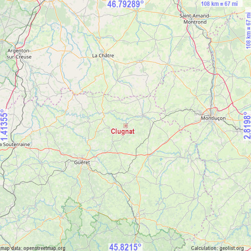
Clugnat GPS coordinates[2]
46° 18' 33.66" North, 2° 7' 0.012" East
| Map corner | latitude | longitude |
|---|---|---|
| Upper-left | 46.79289°, | 1.41355° |
| Center: | 46.30935°, | 2.11667° |
| Lower-right: | 45.8215°, | 2.8198° |
| Map W x H: | 108×108 km | = 67.1×67.1mi |
| max Lat: | 51.07786° ⇑62.2% North |
| Clugnat: | 46.30935° |
| min Lat: | ⇓37.8% South 41.3874° |
| min Long | Clugnat | max Long |
| -5.08615° | 2.11667° | 9.52242° |
| W 44.4%⇐ | ⇒55.6% E |
Elevation
Elevation of Clugnat is 342 m = 1122 ft, and this is 148.3 m = 487 ft above average elevation for this country.
| Max E: |
2333 m = 7654 ft | 15.3% |
| Clugnat | 342 m 1122 ft | |
| Avg. | 193.7 m = 635 ft | |
Min E: |
-1 m = -3 ft | 84.7% |
See also: France elevation on elevation.city.
Geographical zone
Clugnat is located in North temperate zone (between Tropic of Cancer and the Arctic Circle). Distance of this North polar circle is 2252.1 km =1399.4 mi to North.| Distance of | km | miles | from Clugnat |
|---|---|---|---|
| North Pole | 4857.9 | 3018.6 | to North |
| Arctic Circle | 2252.1 | 1399.4 | to North |
| Tropic Cancer | 2543.2 | 1580.3 | to South |
| Equator | 5149.1 | 3199.5 | to South |


Nearby cities:
15 places around Clugnat: (largest is in red/bold)
• Ajain
14.6 km =9.1 mi,  218°
218°
• Bonnat
16.4 km =10.2 mi,  277°
277°
• Boussac
9.1 km =5.7 mi,  61°
61°
• Boussac-Bourg
10.7 km =6.6 mi, 57°
• Châtelus-Malvaleix
7.1 km =4.4 mi,  265°
265°
• Genouillac
10.7 km =6.6 mi,  296°
296°
• Glénic
17.7 km =11 mi,  237°
237°
• Gouzon
16.1 km =10 mi,  144°
144°
• Jarnages
14.4 km =8.9 mi,  190°
190°
• Moutier-Malcard
16.2 km =10.1 mi,  305°
305°
• Parsac
12.2 km =7.6 mi,  167°
167°
• Pionnat
17 km =10.6 mi,  204°
204°
• Préveranges
17.3 km =10.7 mi,  37°
37°
• Saint-Silvain-Bas-le-Roc
8.9 km =5.5 mi,  74°
74°
• Soumans
14.6 km =9.1 mi,  93°
93°
Sources, notices
• [Note1] Compared only with cities in France existing in our database
• [Src1] Map data: © OpenStreetMap contributors (CC-BY-SA)
• [Src2] Other city data from geonames.org with taken over terms of usage.
• [Src3] Geographical zone / Annual Mean Temperature by Robert A. Rohde @ Wikipedia
